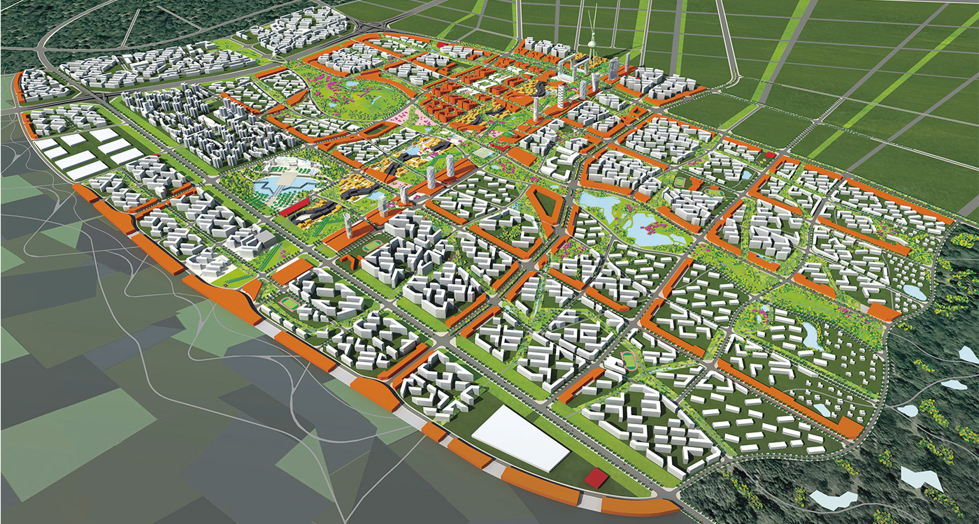
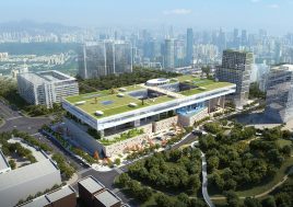
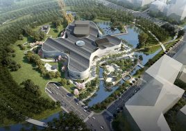
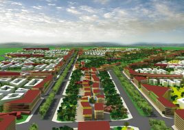
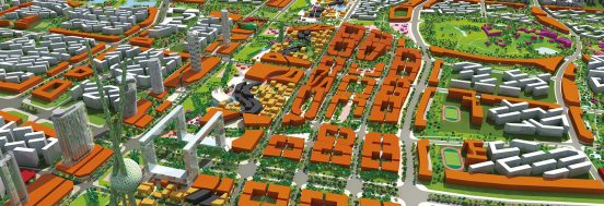
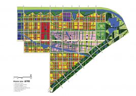
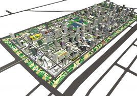
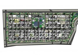
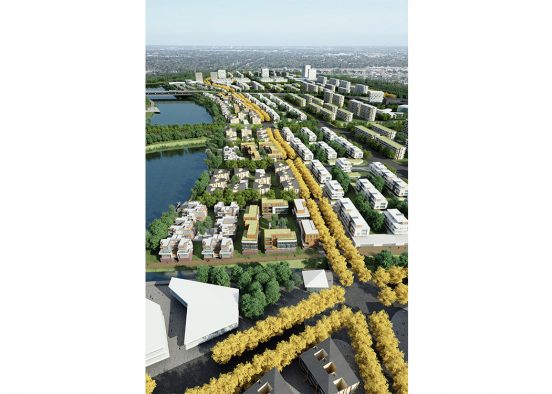
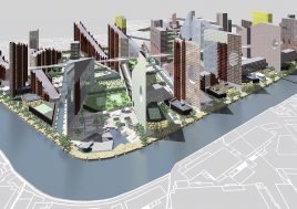
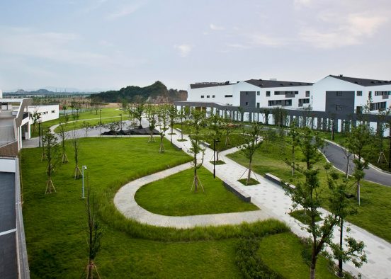
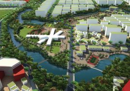
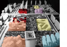
disorder – not randonmness but beyond order:
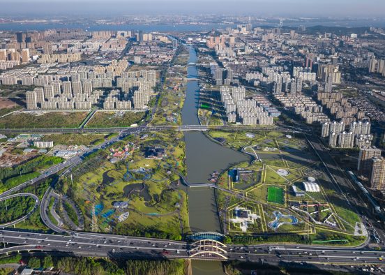
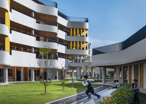
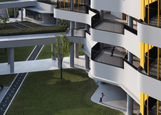
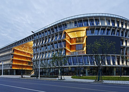
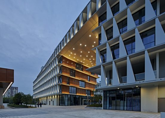
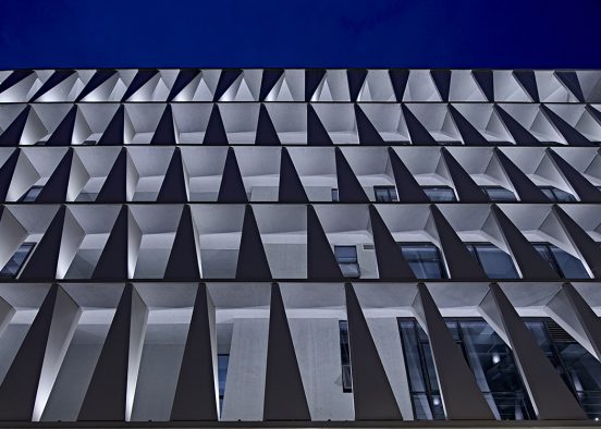
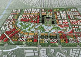
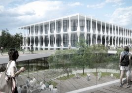
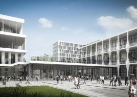
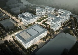
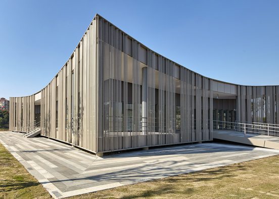
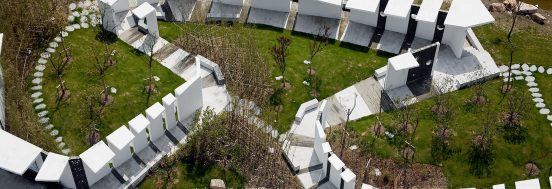
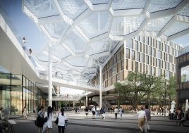
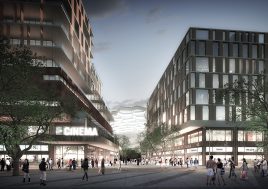
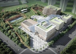
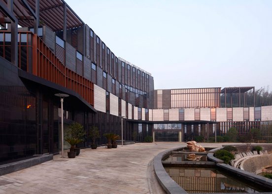
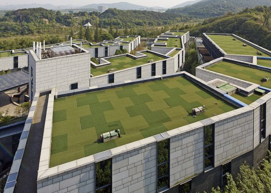
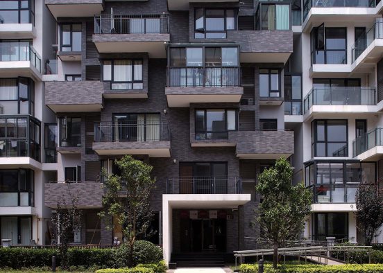
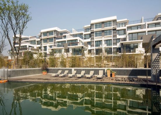
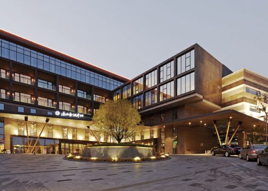
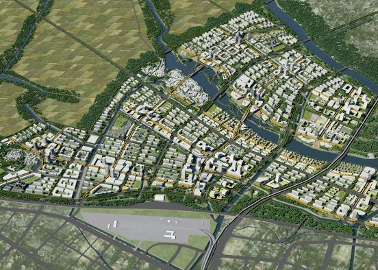
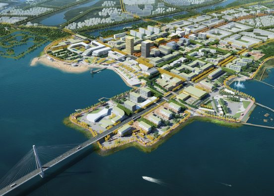
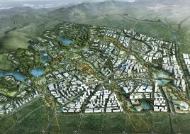
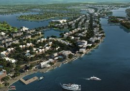
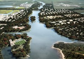
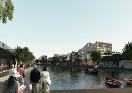
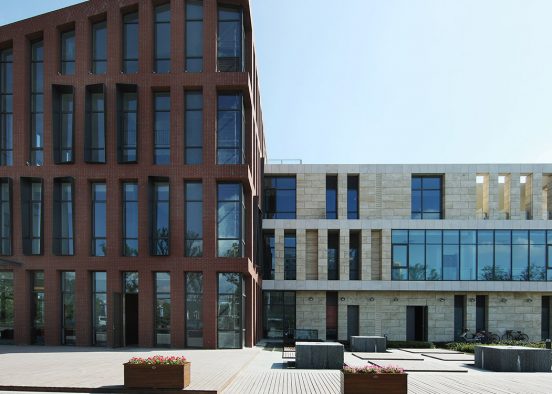
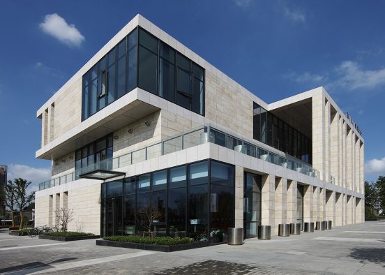
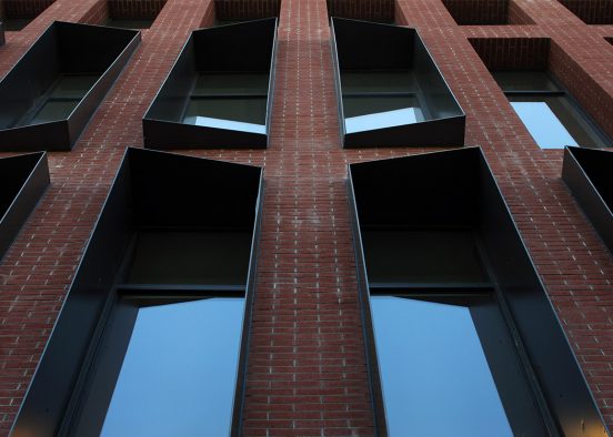
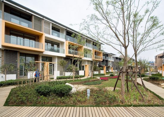
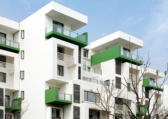
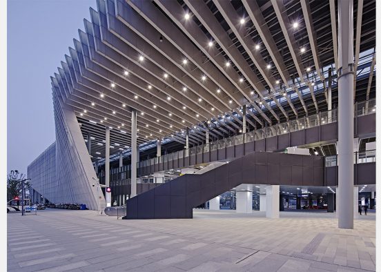
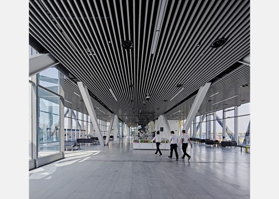
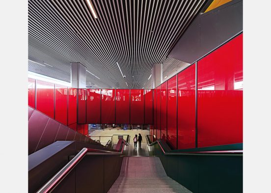
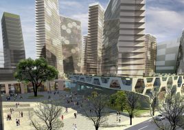
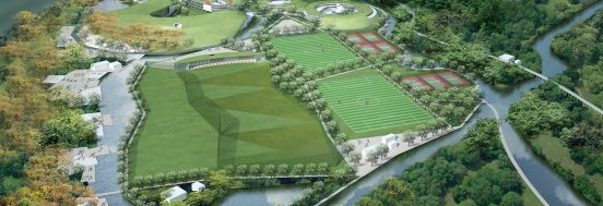
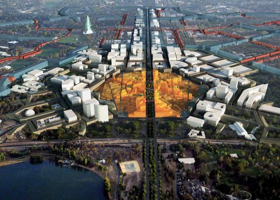
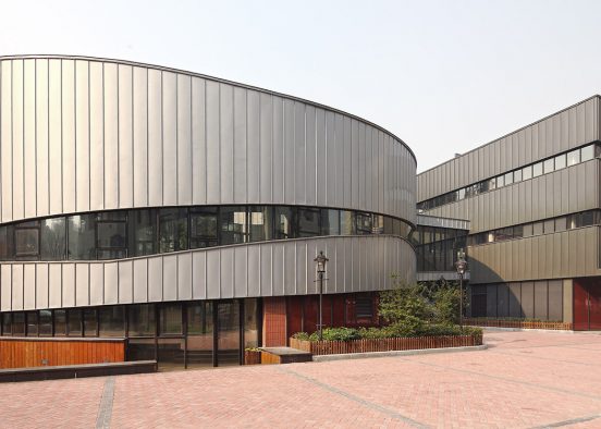
BAU182 Chengdu East Village
Chengdu City, Sichuan Province, China

Discipline
PlanningTypology
Urban PlanningCity
Chengdu City, Sichuan Province, ChinaDate
2005Status
First prize, invited competition (under construction since 2006)Client
Chengdu East Investment CompanyProgram
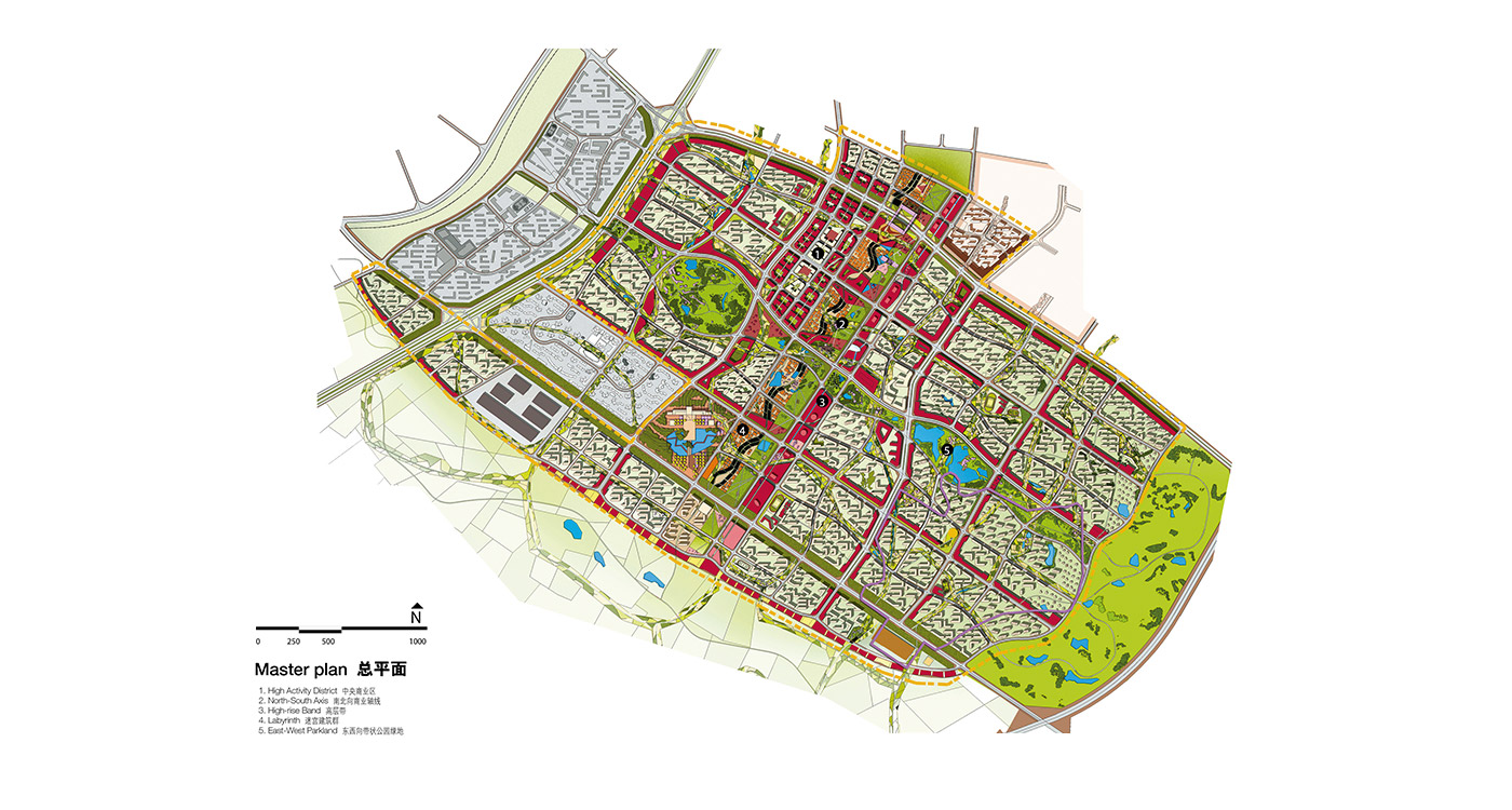
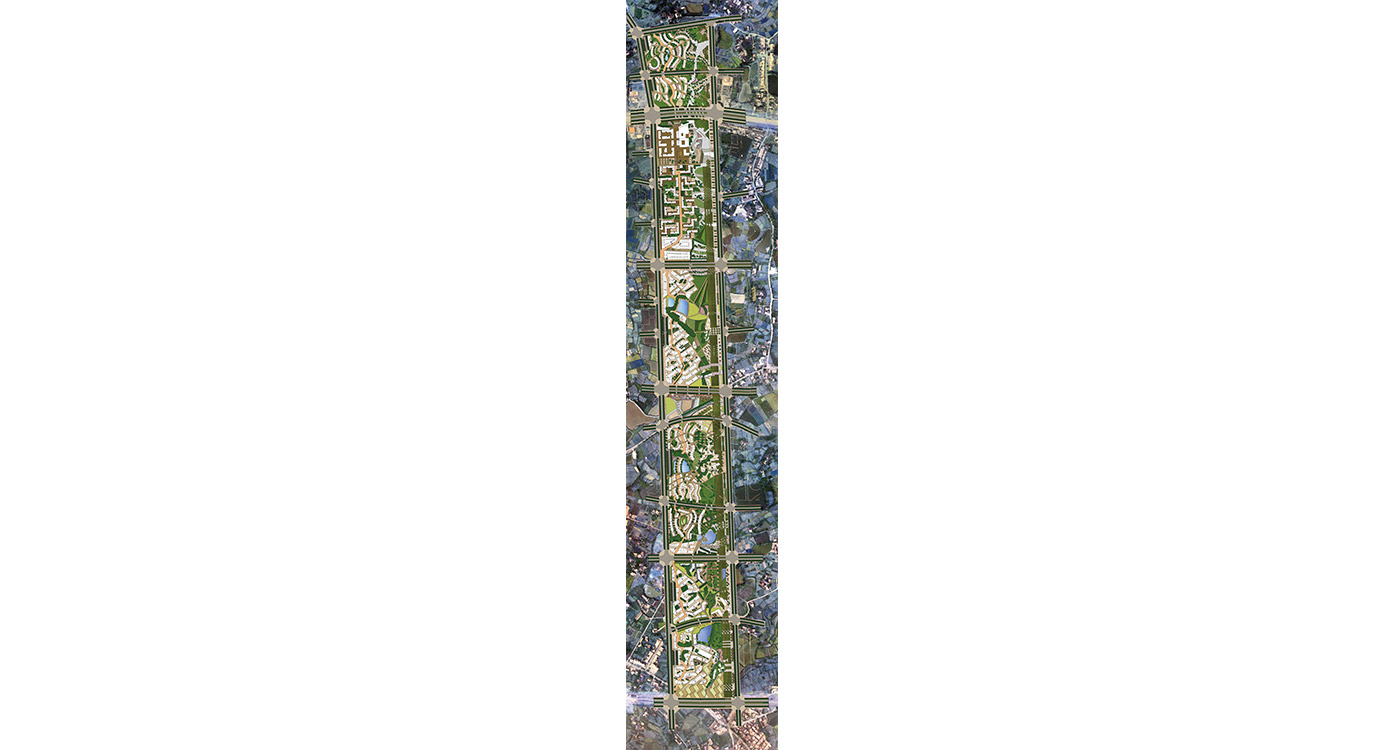
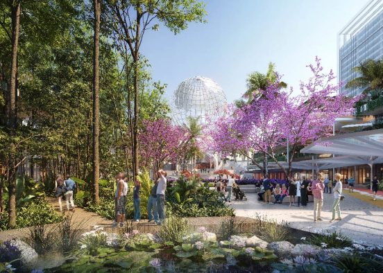
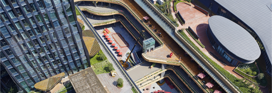
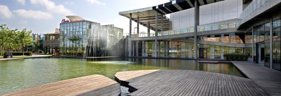
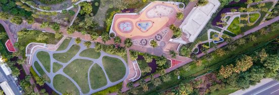
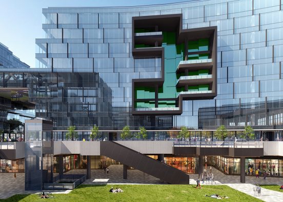
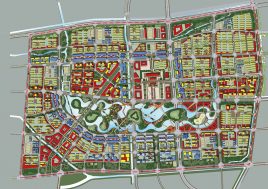
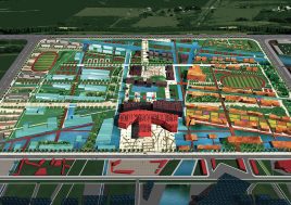
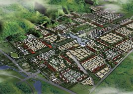
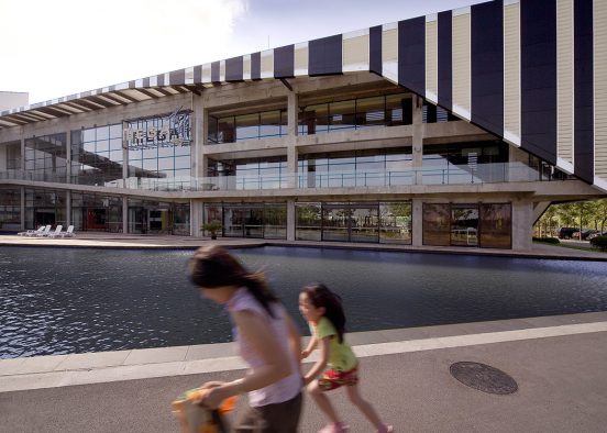
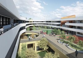
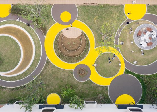
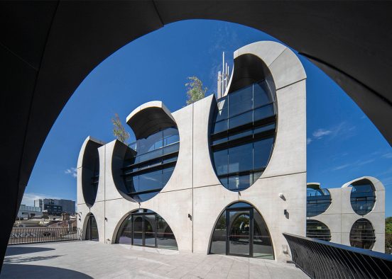
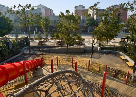
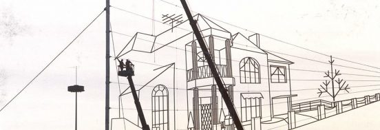
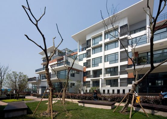
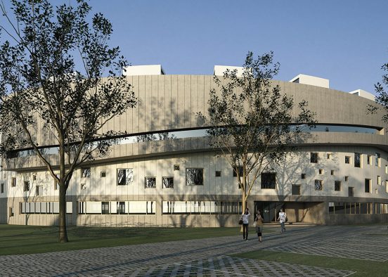
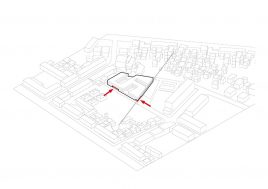
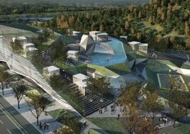
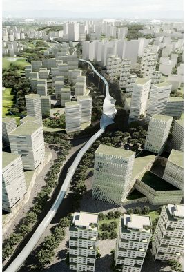
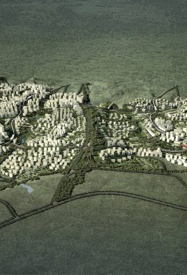
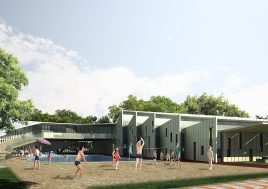
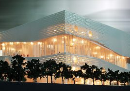
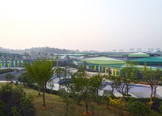
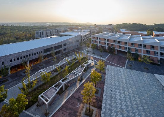
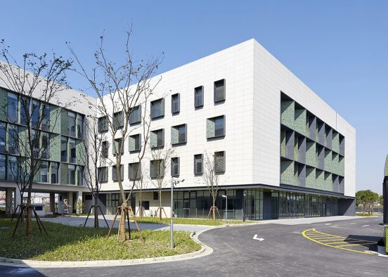
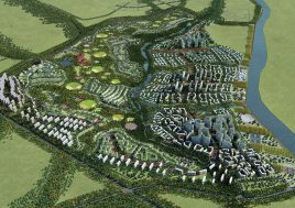
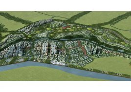
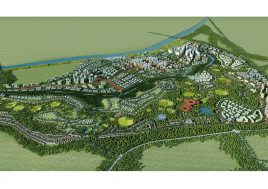
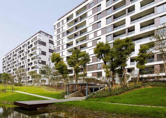
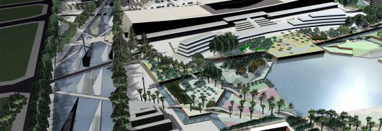
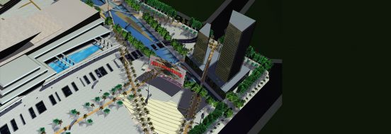
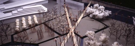
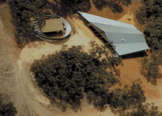
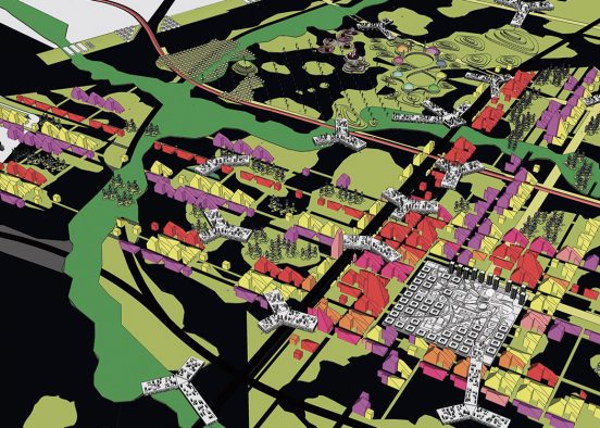
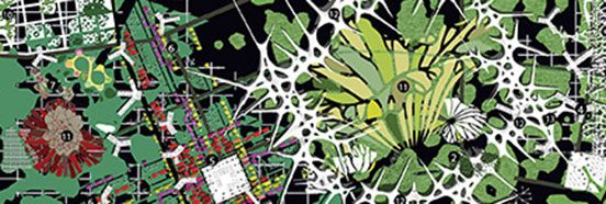
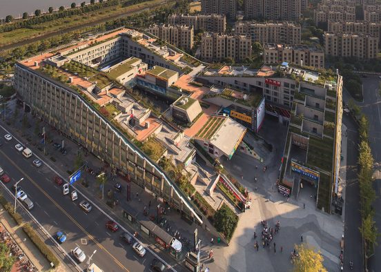
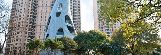
New urban district for 110,000 populationThis project lies within one of Chengdu’s six urban growth corridors and contains one of the metropolis’s ten new city centres. The site is in the eastern part of the city and stretches between the second and outer ring roads where it touches Chengdu’s 1km wide eco ring park. To the south the site borders a green farming finger/wedge whose strategic significance remains undecided.
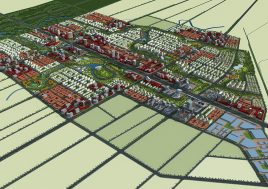
Within the metropolis’s five other growth corridors the city is applying the standard Chinese planning orthodoxy of enormous-scaled mono-functional land-use zoning. At the metropolitan scale the planning may appear reasonable; however at the neighborhood level this approach is creating environments which are socially, economically and environmentally unsustainable. In the midst of this development the city has selected our proposal for an urbanity of finer-scale zoning organized into a structure of continuous networks for this eastern growth corridor. Construction of roads and infrastructure has commenced on the site and negotiations for land sales have commenced.
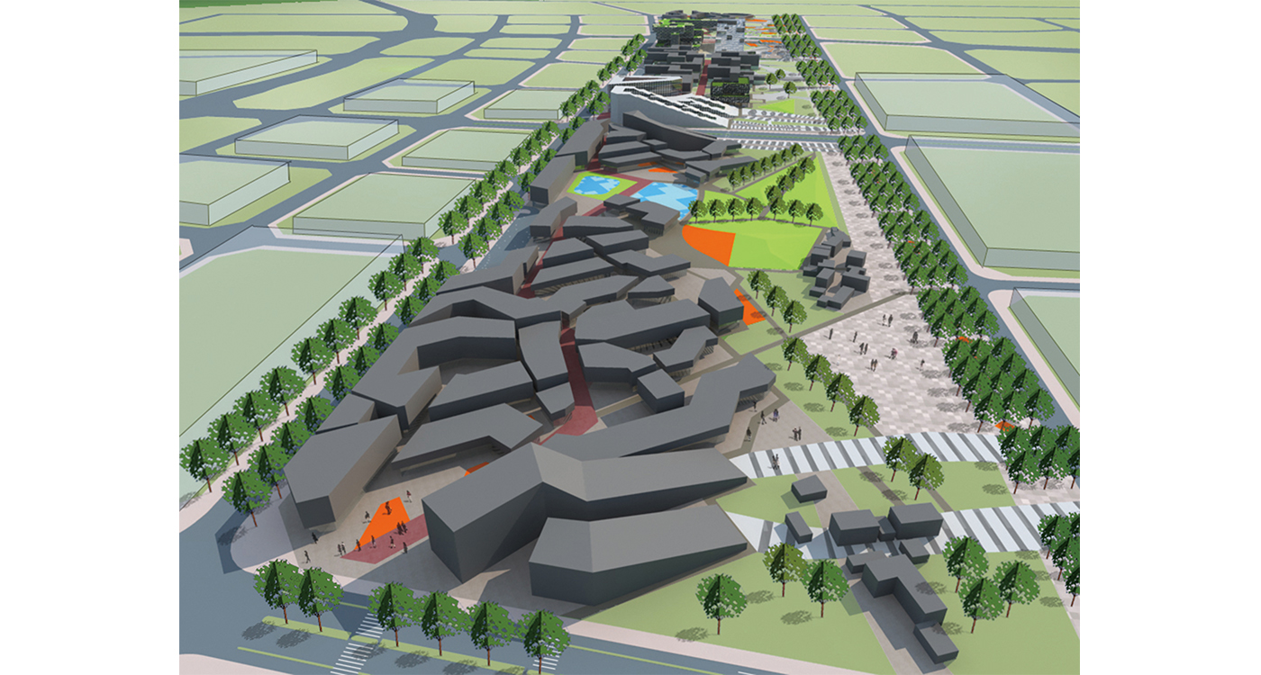
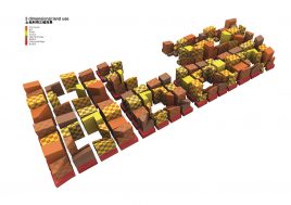
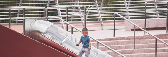
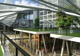
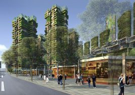
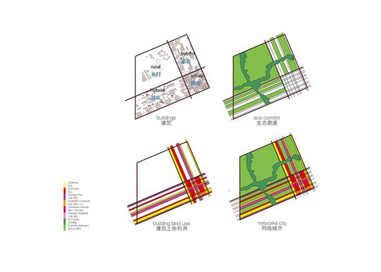
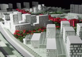
The competition brief, matching the metropolitan plan, called for the design of 12 km2 kilometers of high-density dormitory suburbs with a central business district. Our proposal stretches the CBD into a continuous commercial network across the entire site. This results in a city with the potential to support a plethora of urban life, all within walking distance of residents. Combed with the ubiquitous enclaving of Chinese housing, the city becomes a mix of quiet enclaves and dynamic networks. Highly sought-after quiet, green, clean and safe private living environments coexist with active, complex and unpredictable public urban environments.
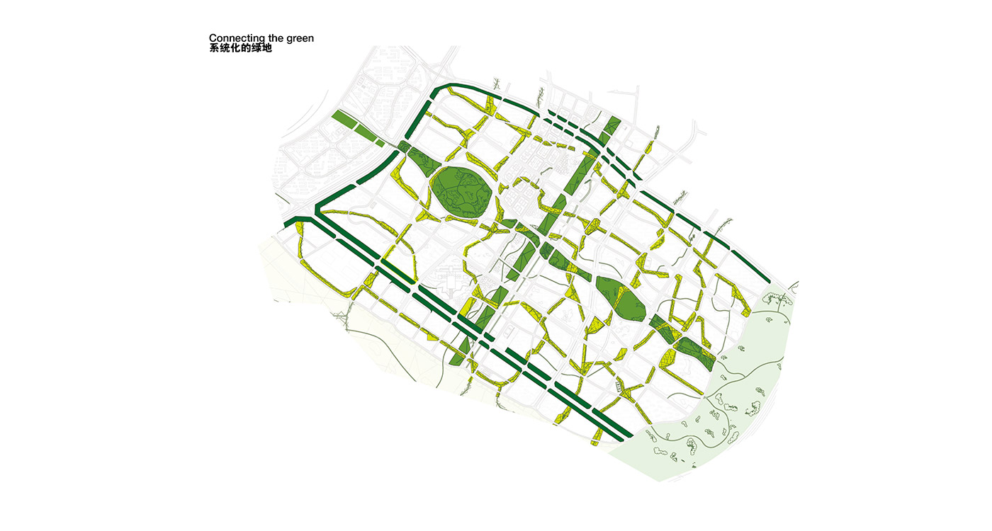
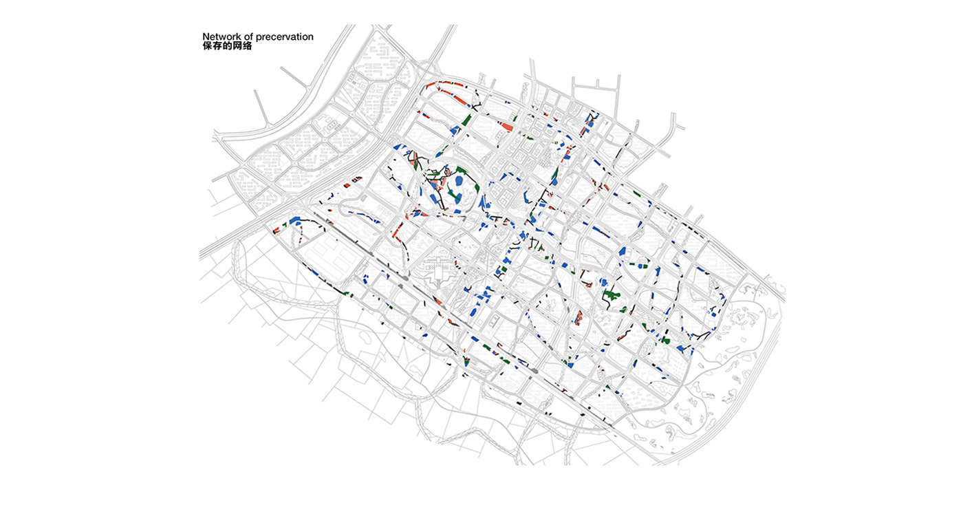
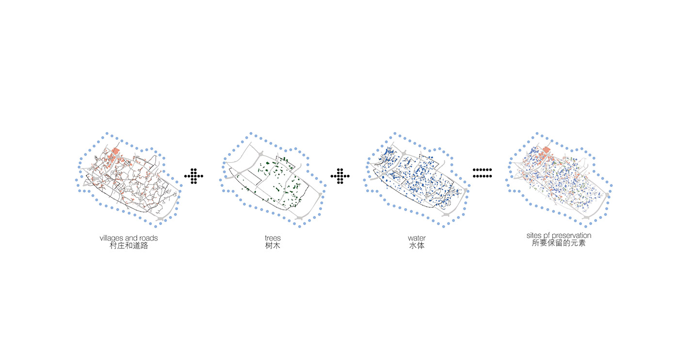
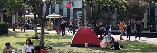
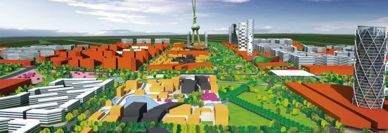
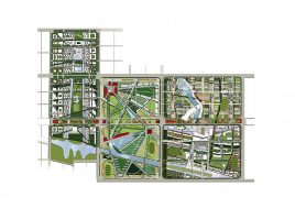
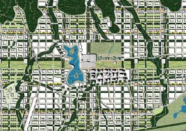
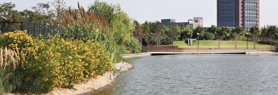
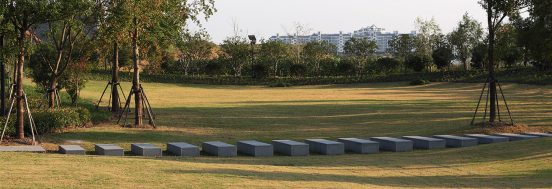
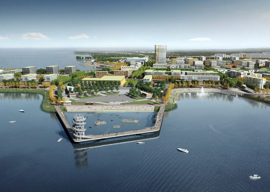
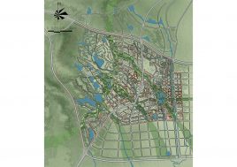
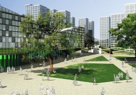
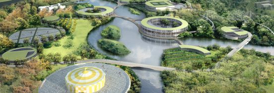
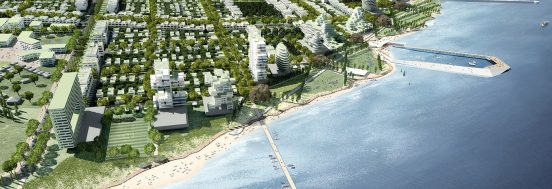
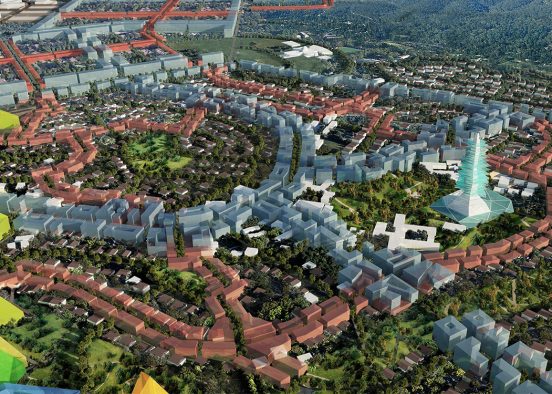
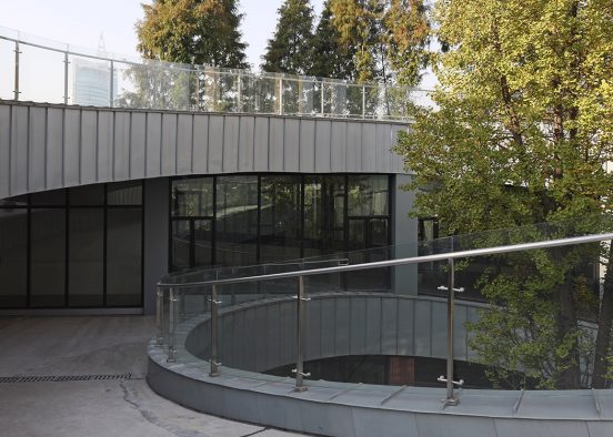
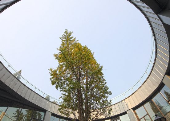
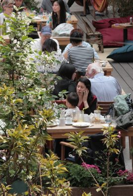
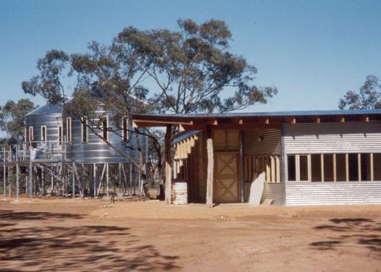
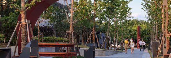
Urbanisation in China is still accompanied by terra nullius and tabula rasa attitudes. However, already emerging on the site, in the villages to the southeast, is a local tourism industry featuring teahouses, restaurants, flower markets and small inns. By designing a park network which engulfs the existing villages with the tree-lined lanes connecting them, dams, and stands of mature trees, it would be possible to maintain and develop this cultural and economic phenomenon within the new metropolis. The new city would be enriched with diversity while the social and environmental upheavals of this urbanisation could be lessened.
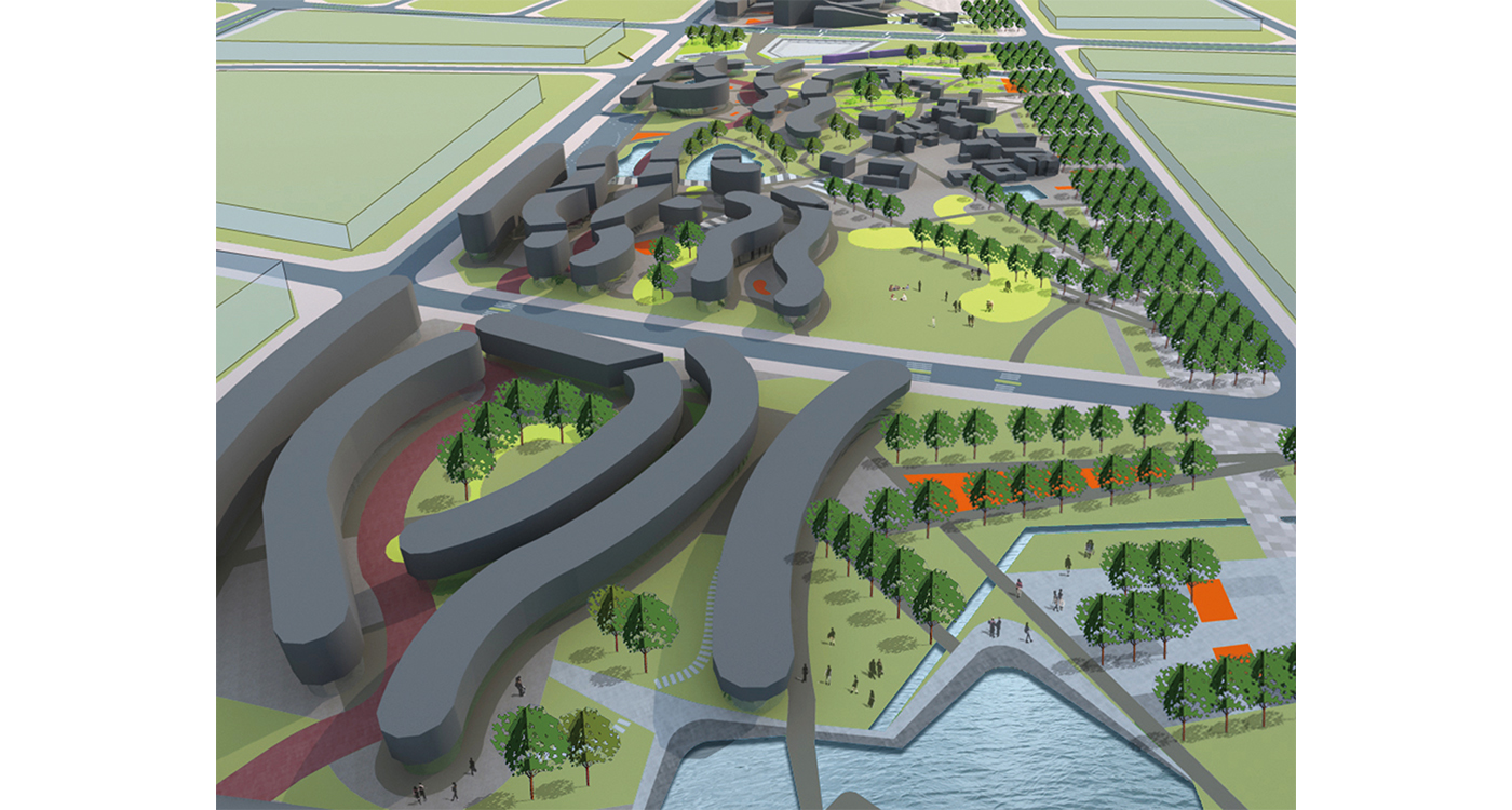
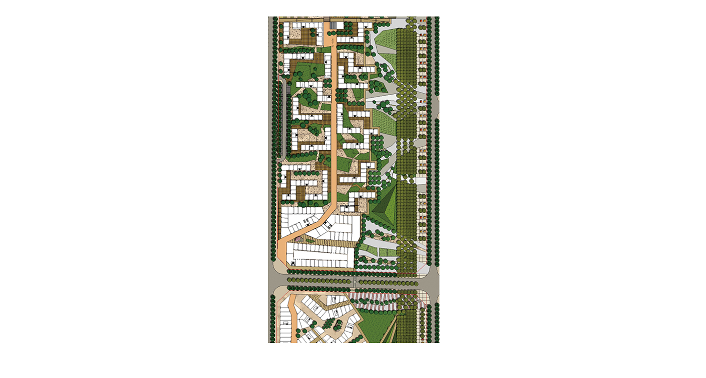
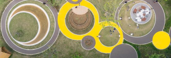
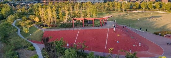
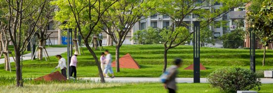
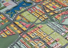
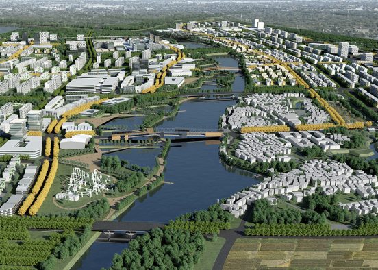
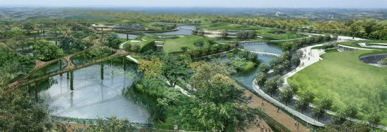
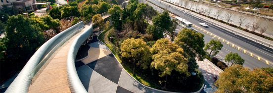
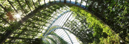
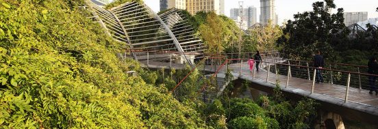
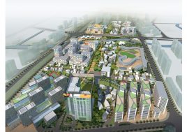
Working with Melbourne landscape architects, Sinatra Murphy, the major east-west park network was developed into three continuous programmatic bands: an ecological band; a linear plaza band with 3km long Wisteria pergola; and a band of sports and recreation. The ecological band links the ecological parkland, on the east, with the rail corridor parkland to the west. Unfortunately, as is common in China – the landscape contract was cancelled without discussion and, in this case, given to a large multinational company. Since then the contract of the multinational has been cancelled and the job given to a local design operator.
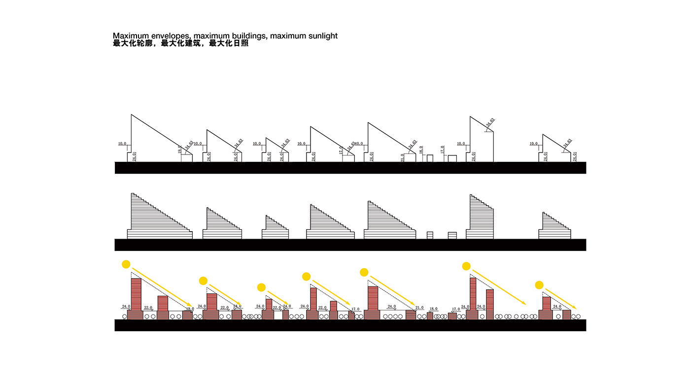
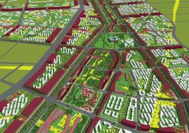
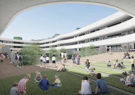
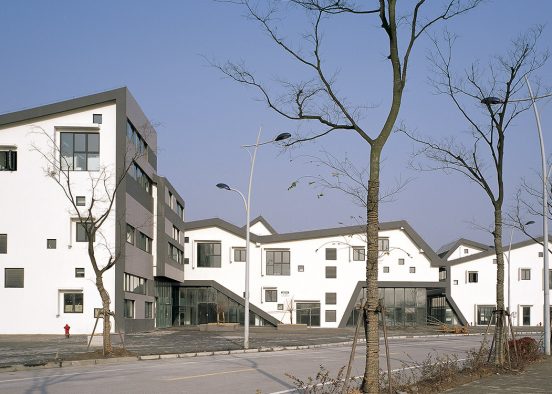
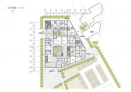
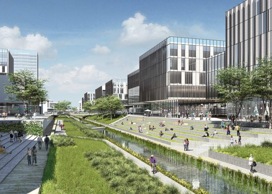
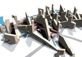
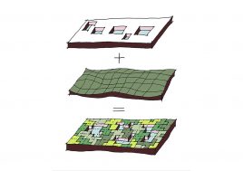
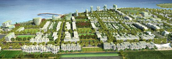
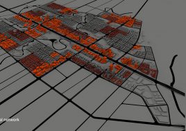
Following the government’s desire to accentuate the unusually hilly character of the site, the proposed street network runs counter to the topography. Two street grids are superimposed: a grid of large straight streets, and a grid of curvaceous smaller streets which run against the contours and weave three-dimensionally. Bicycle routes throughout the site remain flat along the existing tree-lined lanes in the park network.
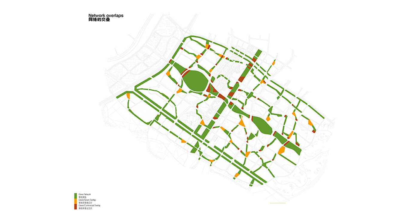
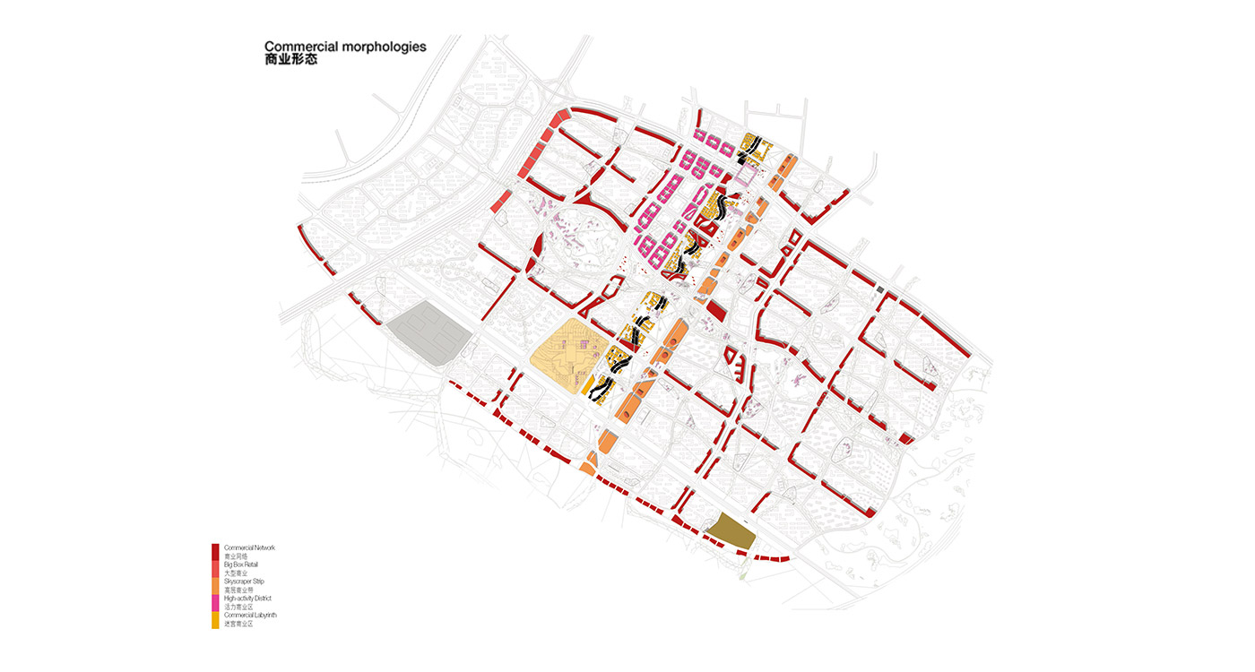
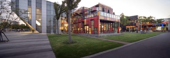
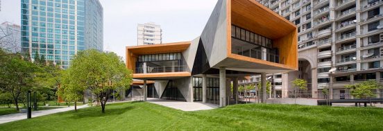
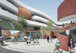
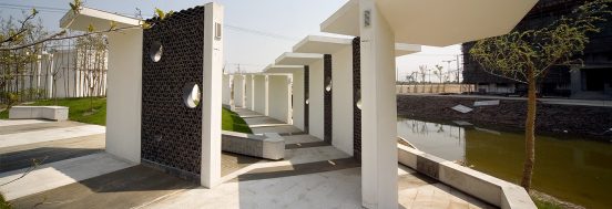
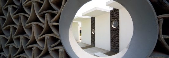
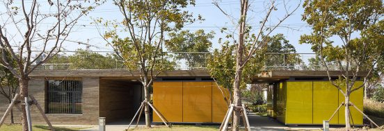
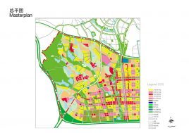
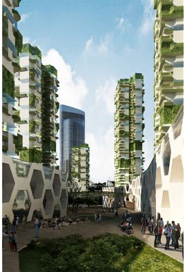
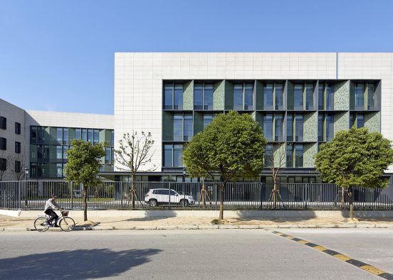
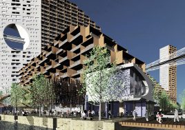
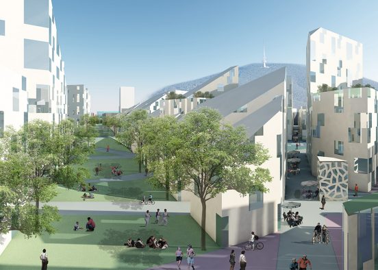
A commercial network is situated on every second street, producing a network of quiet streets and one of active streets. This commercial network is suitable to accommodate programs of retail, offices, and alternative housing typologies.
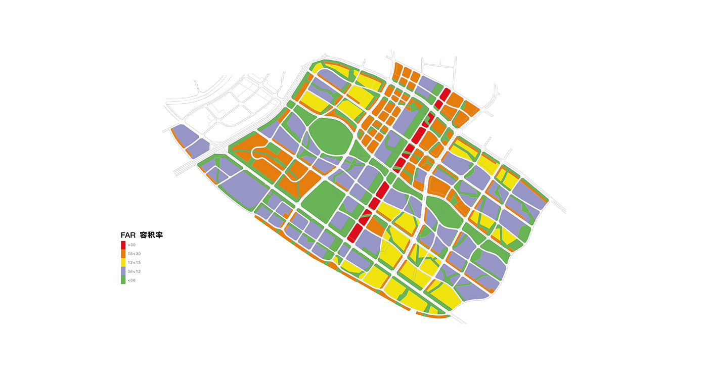
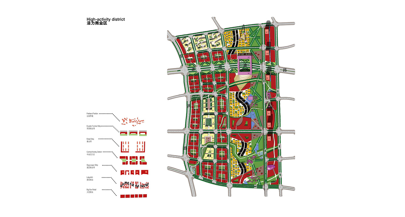
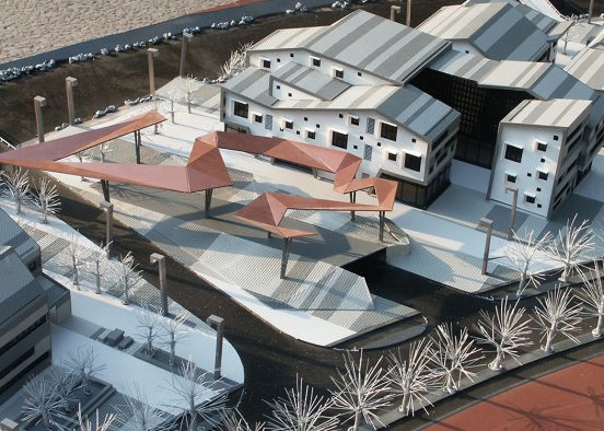
At the intersections or overlaps of two commercial network bands the zone is widened to accommodate larger programs throughout the site. Here it becomes a small pure zone which excludes residential use but allows the emergence of places of potential disturbance such as music venues and light manufacturing. Increasing the FAR and widening the commercial network in the metro station vicinity enables a maximum level of activities in the place of the highest accessibility.
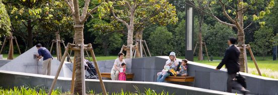
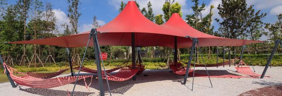
The commercial network is hybridised with green wherever it overlaps the park network and vice-versa. The parks gain a range of potential commercial programs and at the same time the commercial environments gain and are benefited by a range of park programs and characteristics. The overlap allows for the continuity of both networks, the green and the commercial, to be maintained. Throughout the site wherever the green network overlaps itself, plazas and active areas of sports are planned.
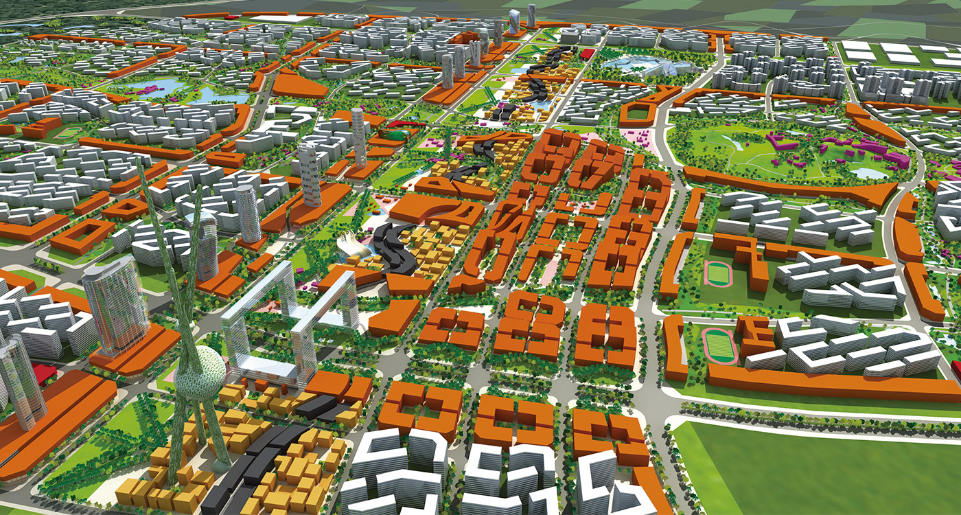
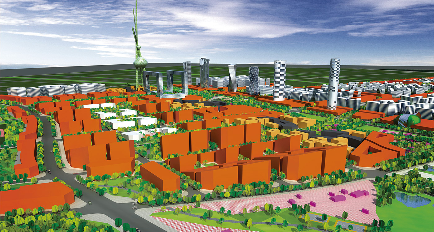
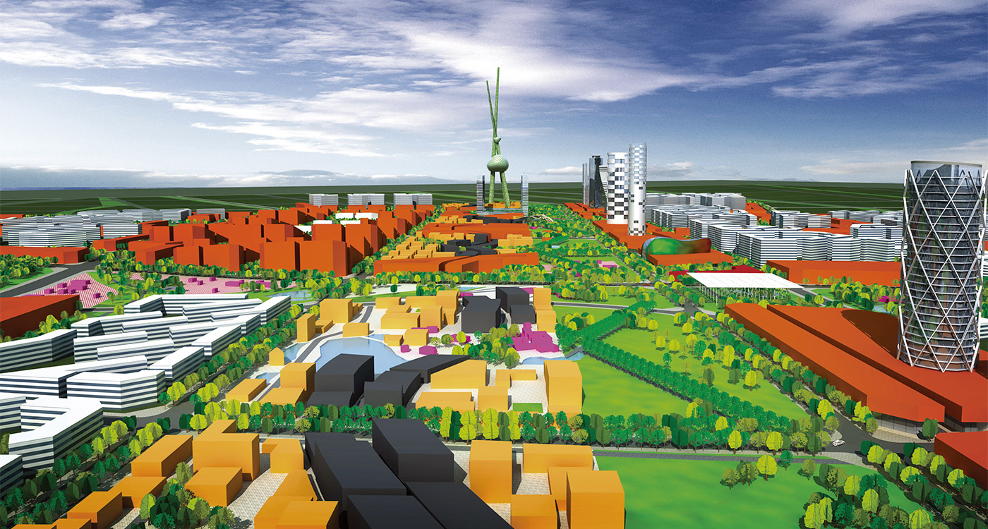
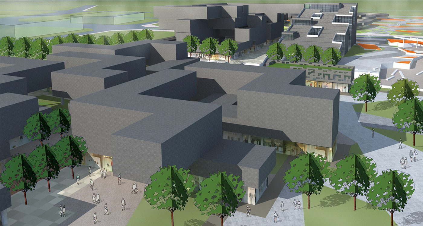
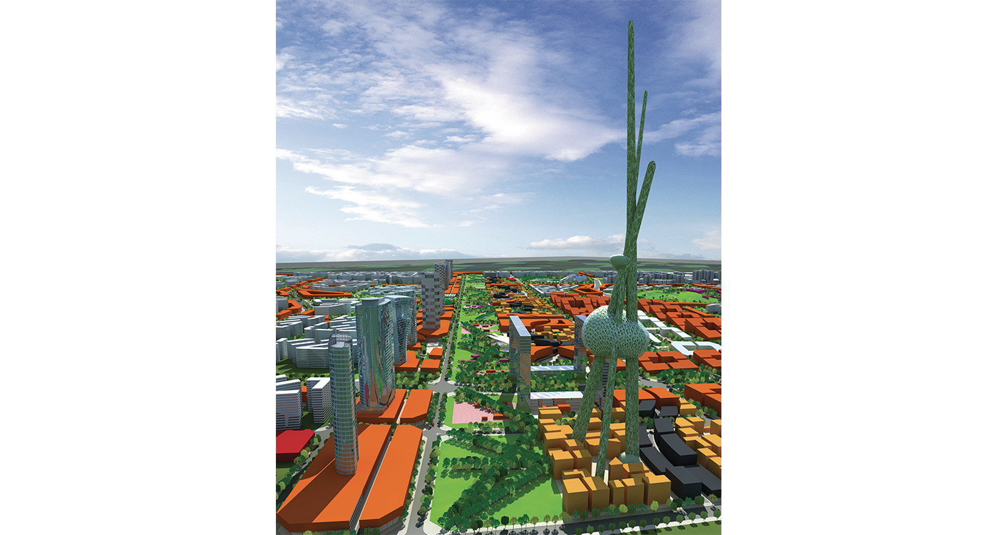
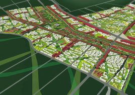
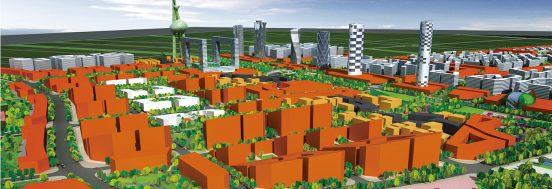
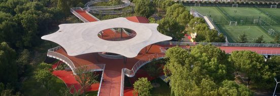
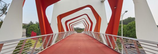
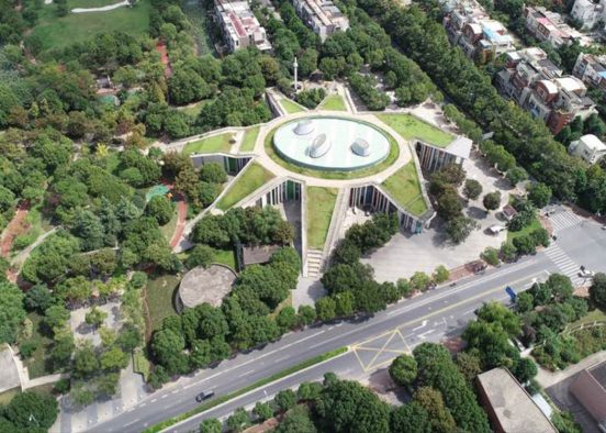
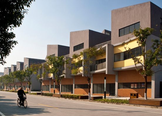
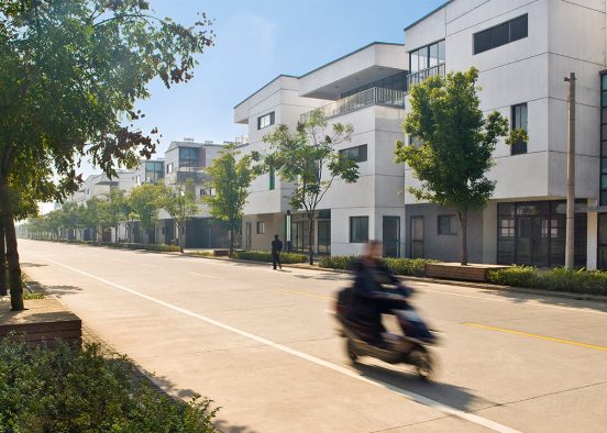
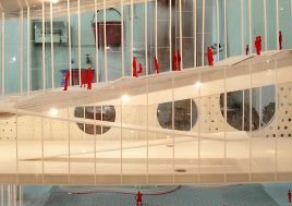
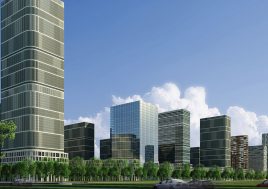
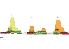
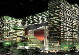
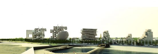
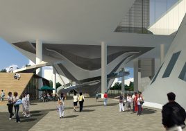
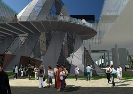
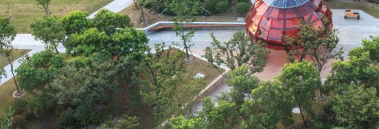
The government-requested north-south axis is manifested in three bands: a 2.5 km long row of landmark towers whose podiums house the district’s biggest entertainment and retail programs; a linear labyrinth of buildings housing the city’s smallest programs; and a linear parkland suitable for festivals and events. Stretching the length of the site, a linear grid of married/grafted trees creates a continuous living structure and promenade. The axis passes through the metro district and continues into the next stage of city development, linking both sites.
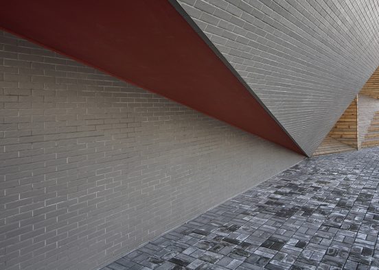
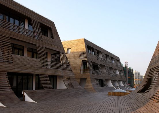
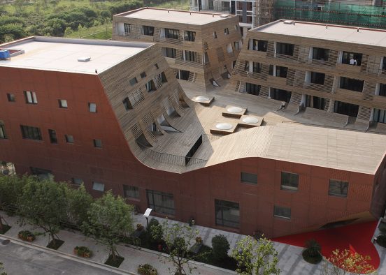
Chengdu has demolished all but two lanes of its small-scale urbanity for which it was famous. The 2.5 km long building labyrinth is a strategy to reintroduce formal and programmatic complexity and to reintroduce areas of intimate scale to Chengdu. The labyrinth is part of the commercial network and will likely house a growing segment of the city’s population who reject or cannot afford the housing enclave option.
After winning the competition, BAU were engaged for a further six weeks to hastily develop their design – more than is usually afforded the urban designers. The project was then adopted by a local design institute that immediately documented the work for state approval. The opportunity for BAU to mature the design, or even to take an ongoing advisory role in the evolution of the district, has regrettably not been forthcoming.
- Infrastructure
- Public
- Residential
- Healthcare
- Education
- Culture
- Office
- Retail
- Hotel
- Hospitality
- Mixed Use
- Sports
- Planning
- Urban Design
- Public Landscapes
- Private Landscapes
- Playgrounds
- Structures & Pavillions
- Residential
- Healthcare
- Education
- Culture
- Office
- Retail
- Hotel
- Hospitality
- 2023
- 2024
- 2021
- 2020
- 2019
- 2018
- 2017
- 2016
- 2015
- 2014
- 2013
- 2012
- 2011
- 2005-2010
- 2000-2005
- 1990-2000
Public Landscapes
2000-2005
2024
Playgrounds
Structures & Pavillions
2016
2023
Public
Education
Private Landscapes
2015
2020
2019
Office
2005-2010
2021
Culture
Planning
Urban Design
2013
Retail
Hospitality
Mixed Use
Sports
Education
2018
2017
Office
Culture
Retail
2011
Residential
Infrastructure
Hotel
Hotel
Healthcare
2014
2012
Healthcare
Hospitality
1990-2000
Residential
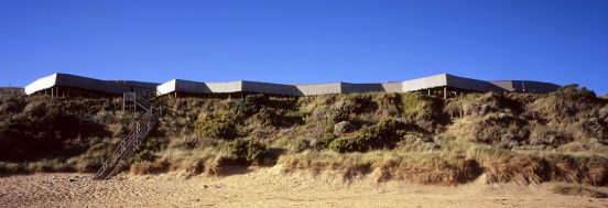
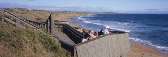
mythological wind machine: BAU025 Whale Watching Platform
CENTRAL PARK, MANILA, PASAY 360
Forming part of Shanghai’s:
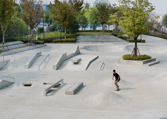
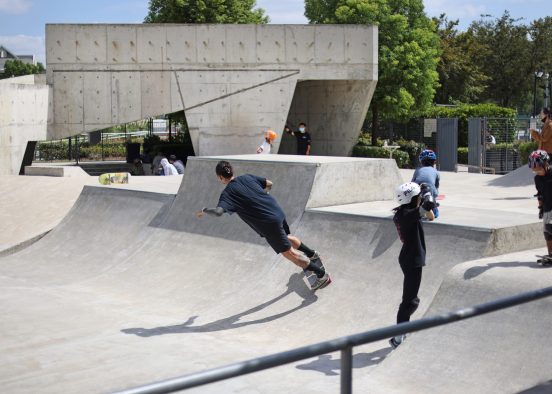
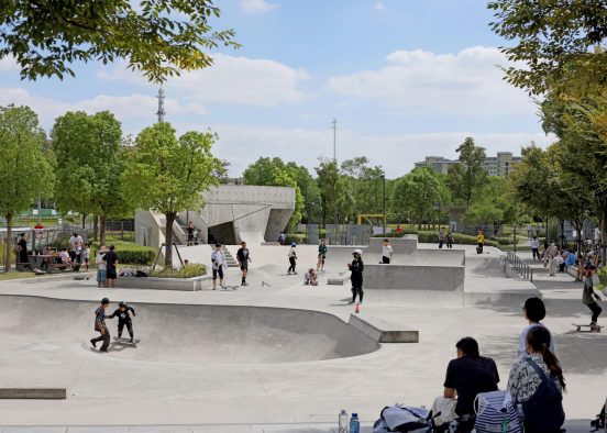
BAU427 Suzhou Creek Linkong Skate Park
100 Parks + One Eco Corridor:
BAU606 Jiangyin Xicheng Canal Parks
learning to let go
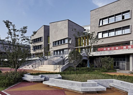
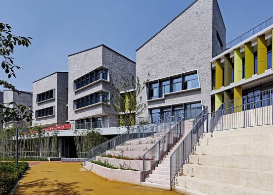
BAU641 Chonggu Experimental School,Years-1-9
an excessive minimalism:
BAU478-A U-Park Incubator, Shang Qing Huai, Nanjing
more Piazza Navona than Levittown
BAU618 Tianyou Experimental Primary School and Kindergarten, Suzhou
more Piazza Navona than Levittown
BAU618 Tianyou Experimental Primary School and Kindergarten, Suzhou
clarity and unpredictable adjacencies:
BAU119 Jinqiao Sports & Leisure Centre
landscape, urbanity, networks, the suitcase, and the paper-bag:
BAU592 Qingpu Zhaoxiang Sports Park, Supermarket + Hotel
more than a frozen moment:
BAU659 ZOOM OASIS, Linkong Perimeter Super Block
look! up in the sky!
BAU210 Shanghai Hongxuan Office Building
Made in China, no question – Invented in China, of course:
BAU588 You-Du R+D Development, Jinqiao, Shanghai
a hybrid infrastructure:
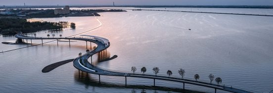
BAU679 Yuandang Bridge
large plains, small grains, and the in-between:
BAU686 Longgang Arts Centre, Shenzhen
on reflection:
BAU674 Qingpu Performing Arts Centre
Place, typologies, programs, and public life:
BAU567 PUKOU COMMUNITY CENTRE
more than just a technopolis:
BAU206 Hangzhou Xiasha New City Centre
a second network embracing history, smalllness, and complexity:
BAU193 Chengdu West New District
a park for everyone and everyone in their park:
BAU189 Hongqiao Park
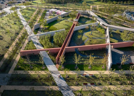
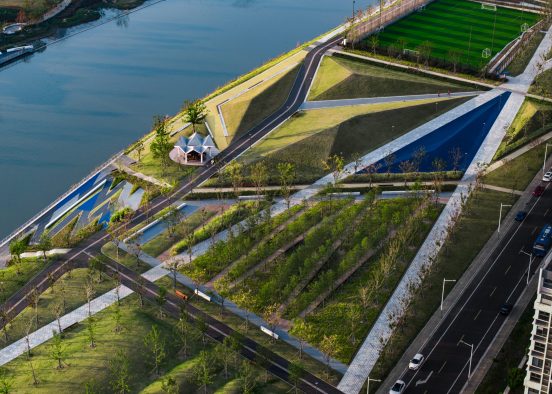
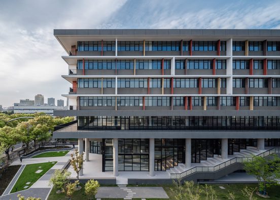
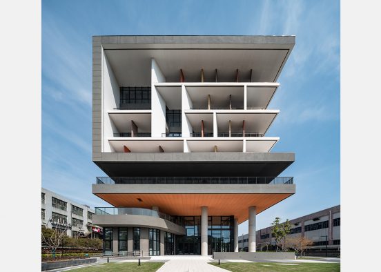
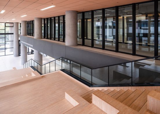
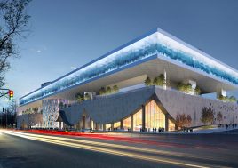
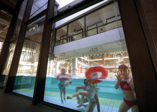
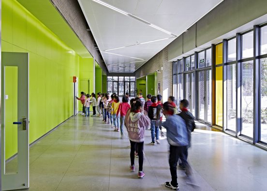
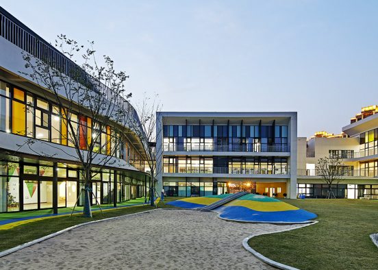
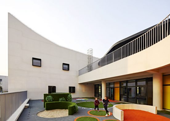
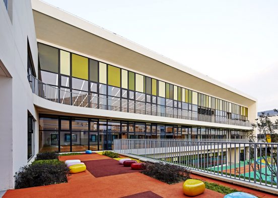
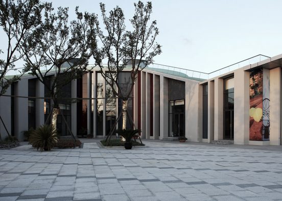
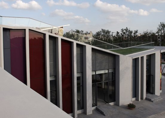
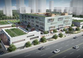
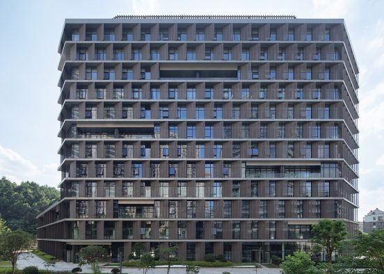
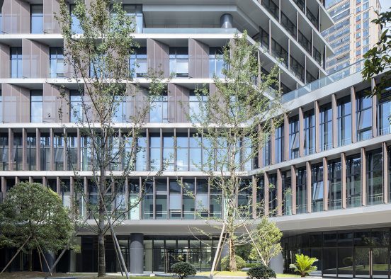
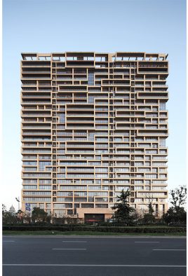
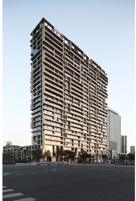
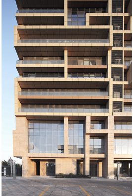
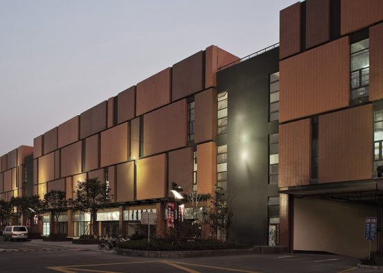
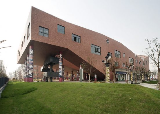
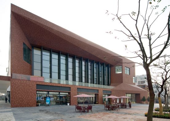
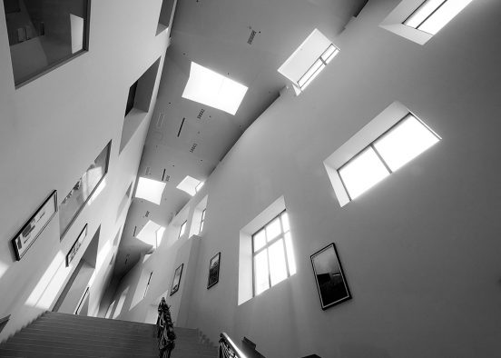
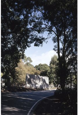
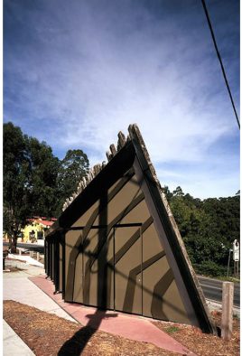
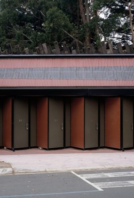
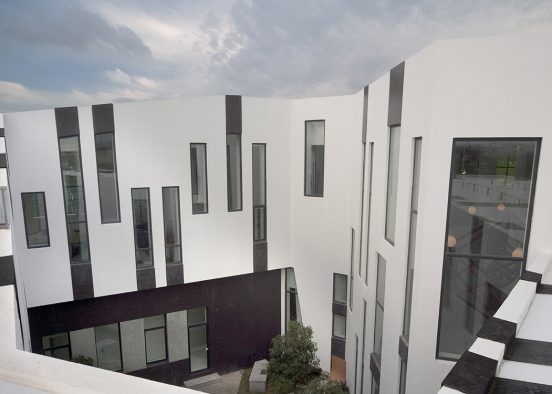
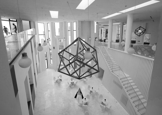
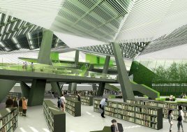
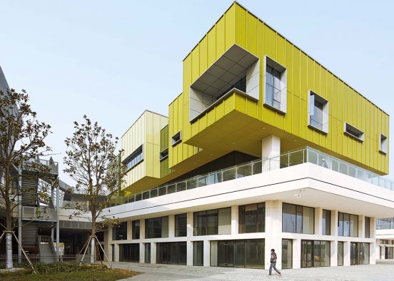
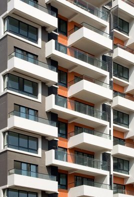
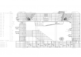
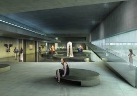
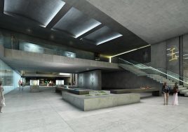
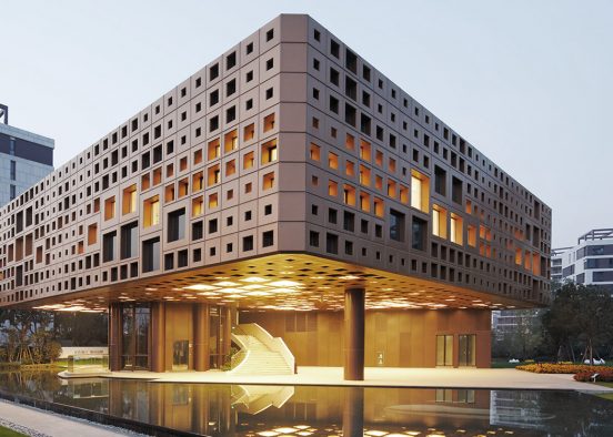
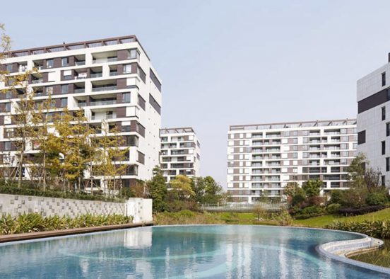
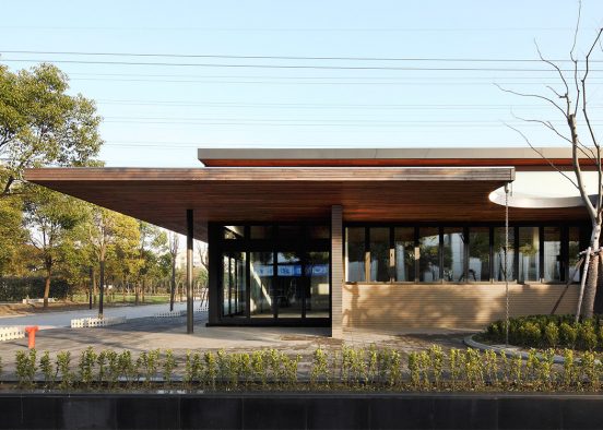
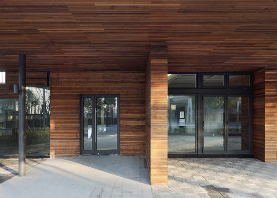
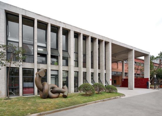
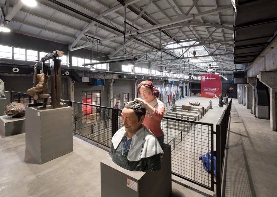
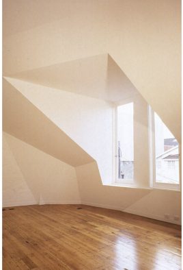
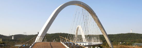
disorder – not randonmness but beyond order:
BAU182 Chengdu East Village
mosaics of teaching, networks of learning:
BAU149 Huai’an Tertiary Education District
walled cities within a walled city:
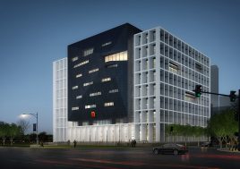
BAU147 Xi’an High-Tech Precinct CBD
co-existence without incompatibility:
BAU138 Jiangxi Xinyu Networks City
space-time conflict:
BAU544 Shanghai University Campus
clarity and unpredictable adjacencies:
BAU119 Jinqiao Sports & Leisure Centre
Journeys AND destination, not just destinations:
BAU569 Nanjing Youfu West Street Primary School
continuous loops and internal courts:
BAU603 Suzhou kindergarten no. 3
weaving and stitching:
BAU616 Jiangyin Greenway Loop (stage 1. Eastern Segment)
a constructed and cultured topography:
BAU269 Jindi Green Land Club
it takes a village to educate a child:
BAU602 Suzhou Sci-tech City Xizhu Kindergarten
city typologies, cultural traditions, contemporary theories, and spaceships:
BAU600 Shanghai Qingpu Newtown 30-class Primary School
artificial plateau:building more site:
BAU599 Shanghai Qingpu Newtown 24-Class Junior High school
it is the least we could do: minimalism in an environment of expressionism
BAU584 Hangzhou Tonglu Office Building
more Piazza Navona than Levittown
BAU618 Tianyou Experimental Primary School and Kindergarten, Suzhou
classrooms AND the in-between: teaching and learning beyond the classroom
BAU610 Taizhou School
other institutions for this new century:
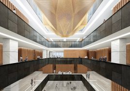
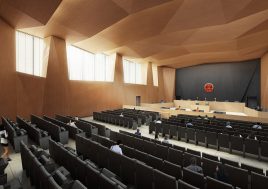
BAU604 Qingpu District People’s Court
building the unfinished:
BAU003M The Victorian Pride Centre
minimal AND maximal:
BAU583 Exhibition Pavilion Gaochun, Nanjing
small in scale large in monumentality:
BAU027 Wyndham Mausoleum
multiple rooms of difference:
BAU253 Shanghai Qingpu Renheng Yunjie Entrance Garden
active cultural edges, passive natural centres:
BAU402 Shanghai Qingpu Qin Yuan Lake Park
intimate, cool, sheltered and lively:
BAU268 Xinqiao Commercial Street + Shop Housing
formal teaching and informal learning:
BAU540 Gaochun New District Kindergaten to Year Nine School
an exercise in robustness:
BAU333 Jiangyin Huifu Office Tower
effortless complexity: learning from water-town:
BAU222-2 Shanghai Qingpu Zhujiajiao Commercial
no longer but not only:
BAU213-3 Jindi Yunhu Market
actualizing the virtual:
BAU 213-2 Jindi Yunhu Sports and Activity Center
geometry, history, art, craft, iconography, and pragmatics: an exploration of intention, coding, narrative, and meaning
BAU021 Olinda Green + Public WC
there is a crack in everything, that’s how the light gets in:
BAU015 Jan Juc House, Victoria, Australia
BAU009 house in the sky
surreal adjacencies:
BAU019 Marymount Residence, Guest Accommodation, Stable + Office
mini-city of culture:
BAU590 Nanjing Pukou Haiqiao Community Service Center
keeping a low profile:
BAU 214 Suzhou Qingshan Hotel Phase I
positive space, human scale, and a blue-green net:
BAU213-1 Jindi Yunhu Housing
dis-integrated guest houses :
BAU495 Pine Pillow Retreat
don’t look at me, don’t look at me:
BAU436 Nanjing Jiangning Demonstration Kindergarten
new buildings, old topography:
BAU424 Suzhou Qingshan Hotel Phase 2
defining the perimeter, programming the centre, inhabiting them both:
BAU238 Town Plaza, Xinqiao, Jiangyin
turning outside-in:
BAU199-2 Wuxi Fudi Forte Parktown Sales Pavilion
beyond PODS, networks, and nodes:
BAU552 Chengbei Urban Design project, Nanjing
podium and bill(ding)board:
BAU547 Nanjing Yaxi Town Central Hospital
inner sanctuary, outer crust:
BAU546 Nanjing Gaochun Qiqiao Hospital
an excessive minimalism:
BAU478-A U-Park Incubator, Shang Qing Huai, Nanjing
a plane of reference:
BAU474 Nanjing Zijin Gaochun Science and Technology City
rips in the fabric by place:
BAU461 Nanjing Tangshan Tourist Resort South District
other ideas of hospital:
BAU446 Fuding Hospital
architecture AND terrain:
BAU445 Suzhou Hi-tech District Cultural Center
crust: in-between and on the edge
BAU426 Shaoxing Jianhu Keyan Tourist Resort Planning
eco urbanism:
BAU425 Chongqing Eco Valley City
microcosm:
BAU348 Kunshan Hyper Complex
beyond the picturesque:
BAU347 Kunshan White Pagoda Park
don’t just re-use the typology, improve it!
BAU310 Hangzhou Changbanxiang Housing
building a community not just housing:
BAU302 Shanghai Ludi Baoshan
upside down program – ‘private’ circulation becoming ‘public’ circulation:
BAU254 Shanghai Wai Gao Qiao Culture Centre
extra-large private space as public space:
BAU199 Parktown, Housing, Fudi Forte, Wuxi
mini-me:
BAU197 Jindi Sanlin Pavilion
staggering:
BAU191 Wuhan Cuiwei Housing
urban camouflage:
BAU227 Hangzhou Sports Centre
the resort at the end of the yellow dirt road:
BAU543 Emerald Village at Soul Bay
critical regionalism and abstraction:
BAU487 Nanjing Yaxi Citta-Slow
hospital for the ill, health care for the healthy, aged care for the elderly: BAU469 Zhaoxiang Hospital
tear open the package: BAU247 Qingpu NGS Supermarket
urban sponge:
BAU324 Cixi Commercial and Culture Center
lyrical islands in pragmatic seas:
BAU530-1 Nanjing Gaochun Transport Interchange – Stage One
fractured enormity:
BAU281 Chongqing Huarun
ring roads AND peripheral parks:
BAU243 Shanghai Ring Park
simple box OR 3 points in space – you choose:
BAU204-2 Ningbo Wanda Office
many utopias:
BAU129 Xinhu Pearl City Housing Development
a close family:
BAU125 Zhejiang Power Company HQ
stretching, squeezing, bending, trimming:
BAU550 Huanglong Xigu Urban Design
BOTH networks AND objects:
BAU497 Wyndham Cove Eco Sub-urb
ethics, democracy, difference:
BAU470 Towards a Socially Sustainable Canberra
warp and woof:
BAU460 Jingzhou Museum
sustainable technologies for clean living:
BAU396 Nanjing Residential
network of learning:
BAU341 Yushanwan School
not in galleries, but a way of seeing:
BAU338 Jingqiao Ramp Restaurant
shopping sandwich:
BAU321 Jiangyin Wuxing Commercial Centre
celebrating the collective, the intimate, the sustainable, and the local:
BAU312 Suzhou School
21st century Ponte Vecchio:
BAU287 Shanghai 2010 World Expo Bridge
antidote: not another ghetto city:
BAU285 Chengdu North Central
at last …finally …some diversity:
BAU282 Jindi Sanlin Office
recycling and beyond
BAU264 Shanghai Jiashan Market
an assemblage of difference:
BAU256 Shanghai Hongqiao Performing Arts Center
streets as shelters, bars as amphitheaters, landscapes as playgrounds:
BAU235 Jinqiao Community Bars
reduce, reuse, recycle:
BAU220 Shanghai Sculpture Space
binary oppositions defining a field of operation – all we wanted was a park:
BAU122 Xiamen International Exhibition Centre
the hotel as microcosm of the city:
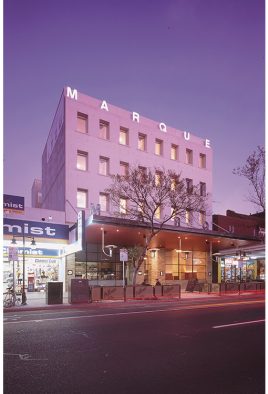
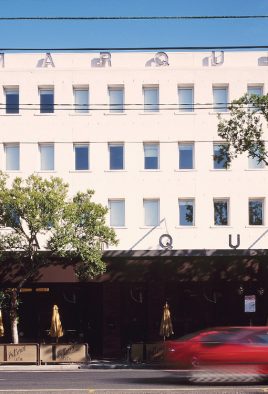
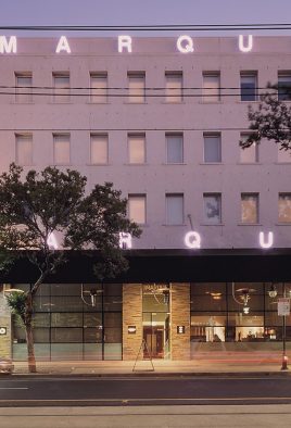
BAU018 Marque Hotel
…very strange:
BAU016 Penny Lane
the beautiful and the extraordinary:
BAU013 Hopetoun Bush Resort
a dynamic yet stable vehicle:
BAU510 Suzhou Tram Co. Headquarters
palimpsest:
BAU486A Docklands Park, Yangtze River, Jiangyin
innovation both inside and out:
BAU433 Zhangjing Nobel Lake Park & Network
exquisite corpse
BAU416 Genetic City Caofeidian
landscape becomes urban design becomes architecture:
BAU390 Duolan Dong Dong Mixed Use Complex
BAU386 Symbiotic City


repetition and difference:
BAU384 Kunshan Pavilions
no longer drowning – waving:
BAU339-2&3 Suzhou Creek Promenade


yet another point of view:
BAU339-1 Suzhou Creek Serpentine Park
ordinary not heroic, symbolic not monumental:
BAU318 Hangzhou Xiaoshan Government Headquarters


woven threads:
BAU234 Jiangyin Arbour Park
private precincts, public networks:
BAU226 Pudong Yangjing
creative networks:
BAU224 Chengdu Fenghuangshan


maximize commuication and cross fertilization:
BAU208 Linping New City Centre


