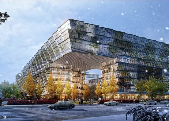
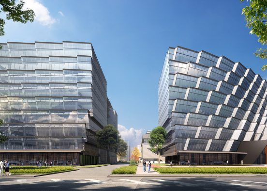
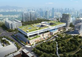
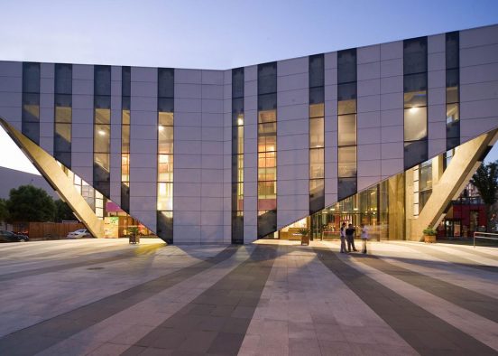
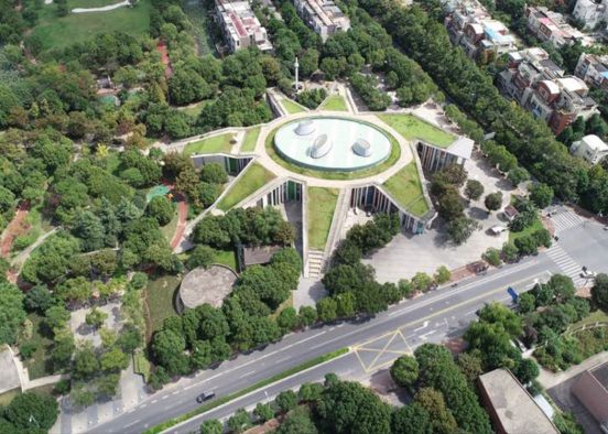
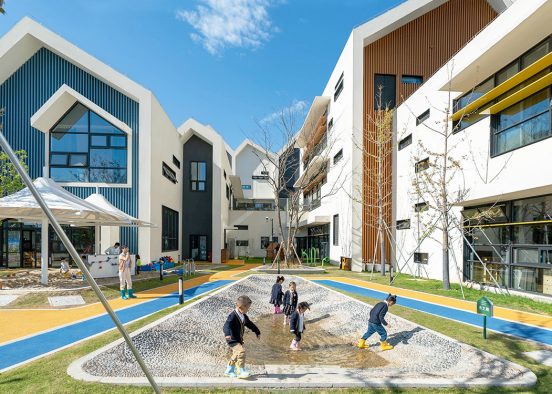
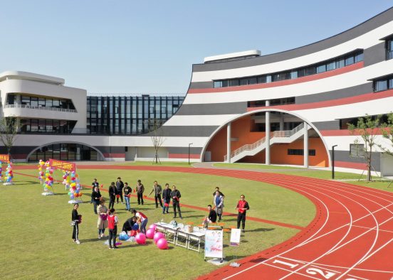
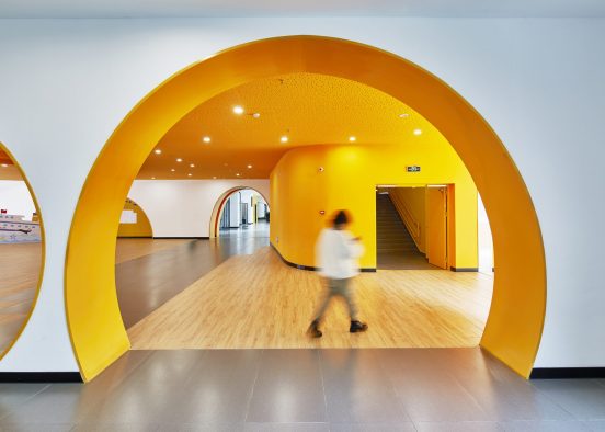
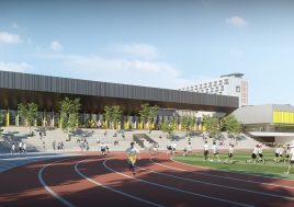
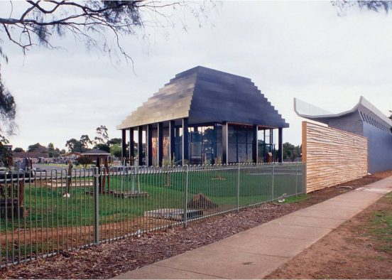
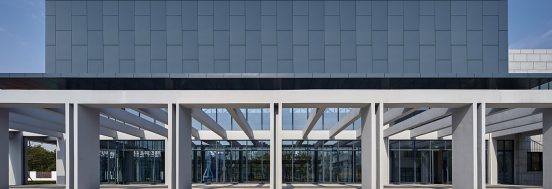
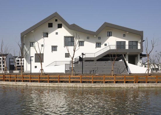
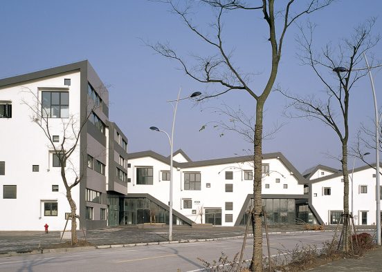
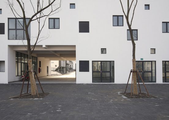
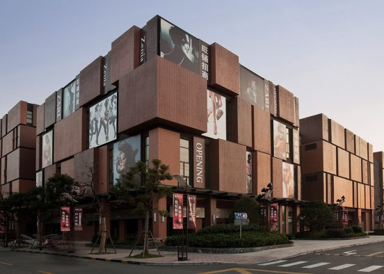
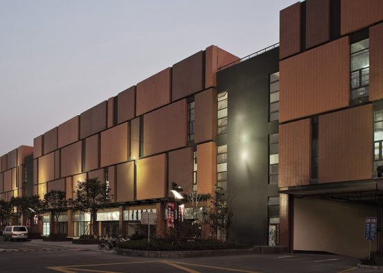
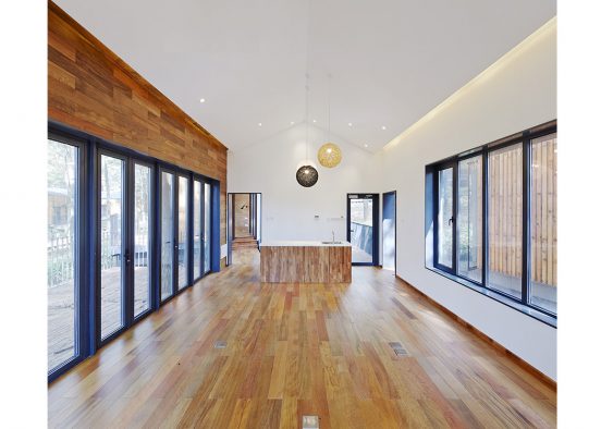
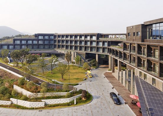
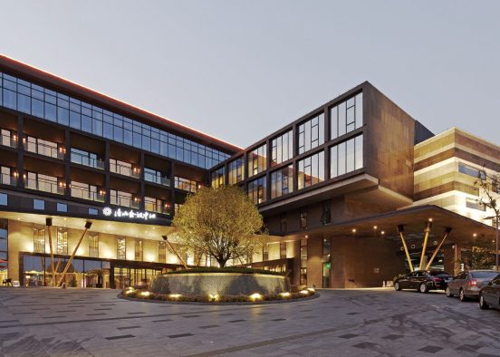
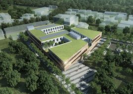
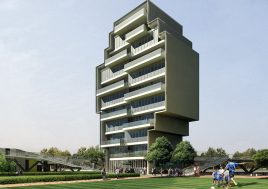
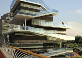
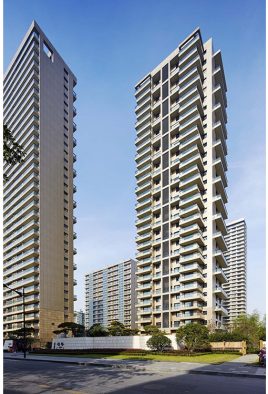
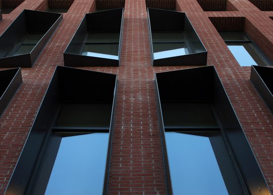
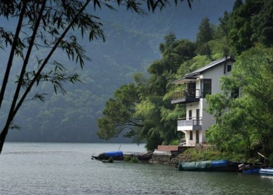
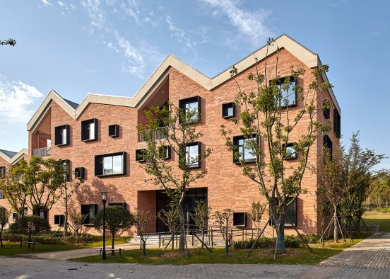
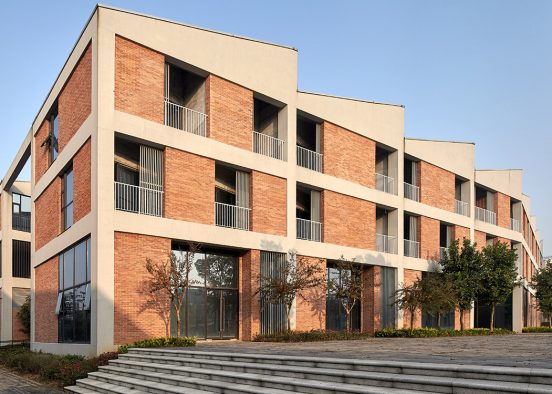
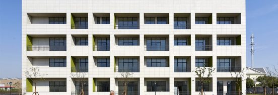
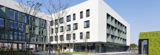
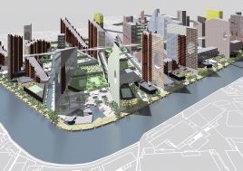
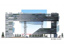
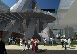
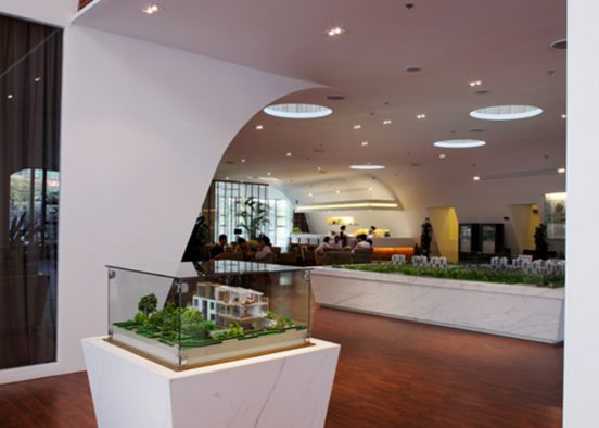
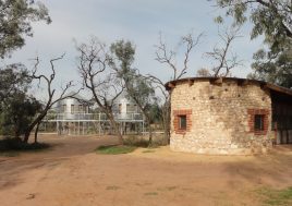
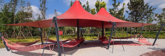
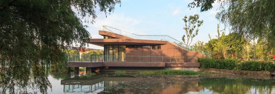
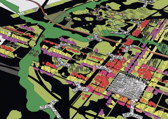
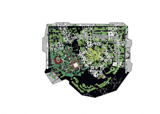
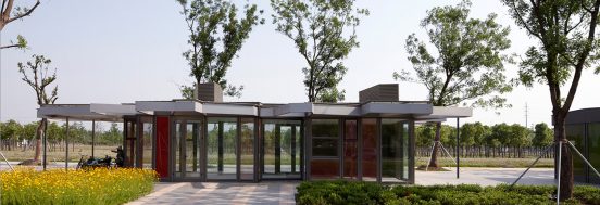
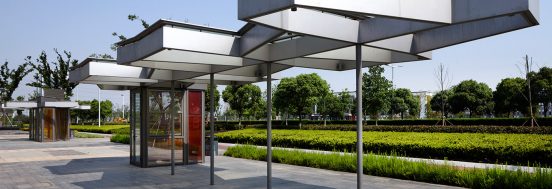
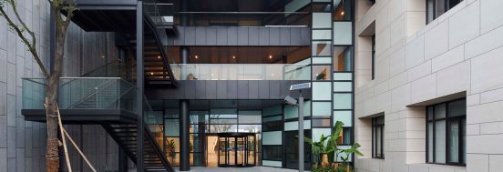
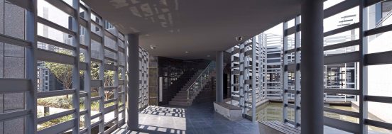
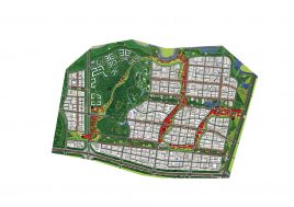
BAU474 南京紫金(高淳)科技创业特别社区城市设计
中国,江苏省,南京市
科目
规划类型
城市设计及规划城市
中国,江苏省,南京市时间
2011-2014名次
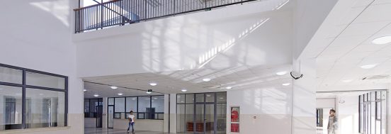
控规已完成,现一期部分修建性详细规划设计中业主
南京高淳县住房和城乡建设局项目
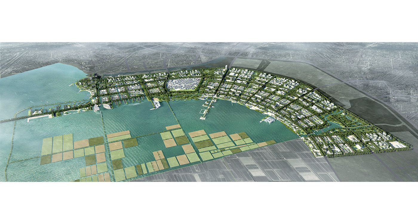
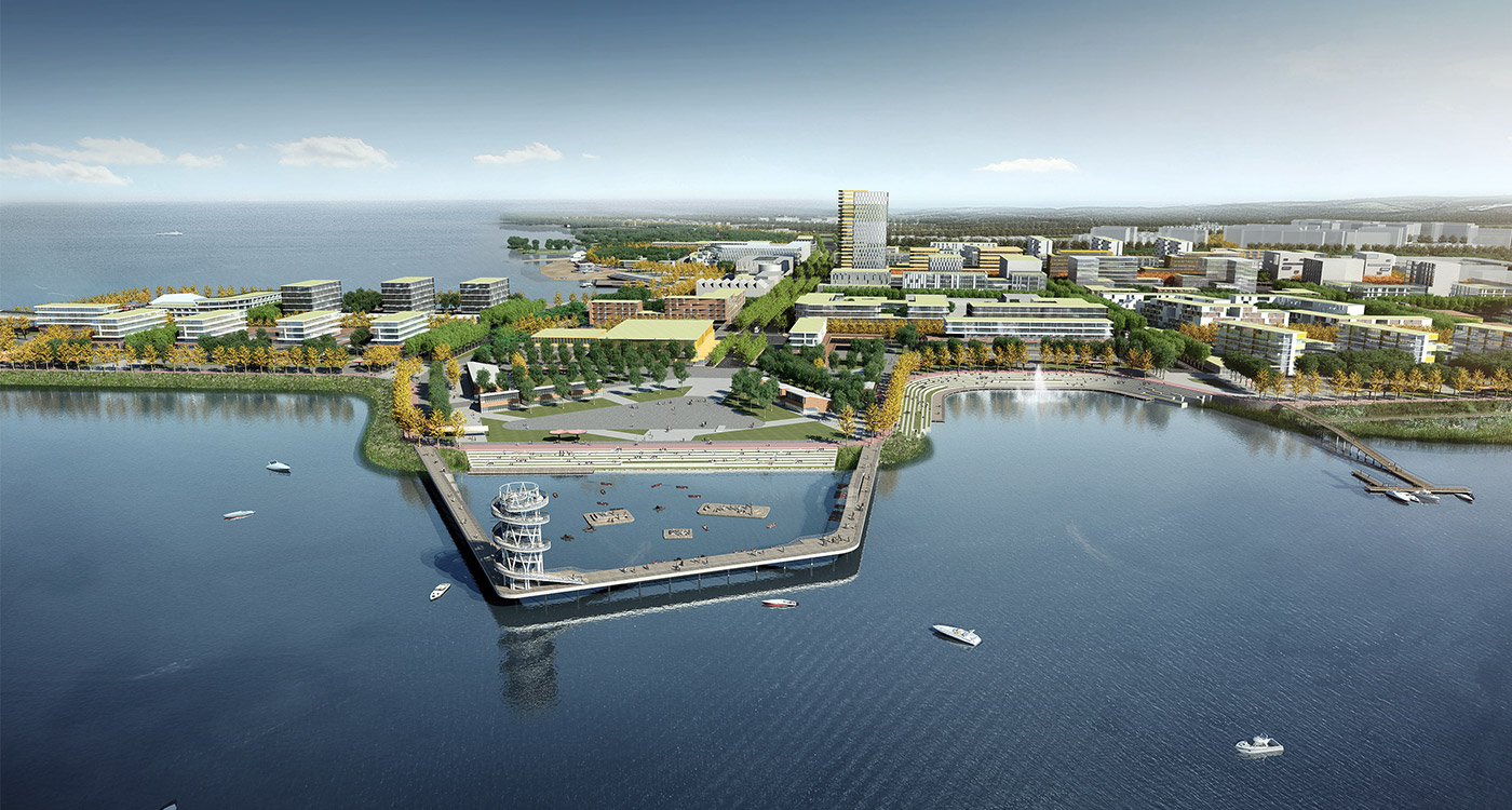
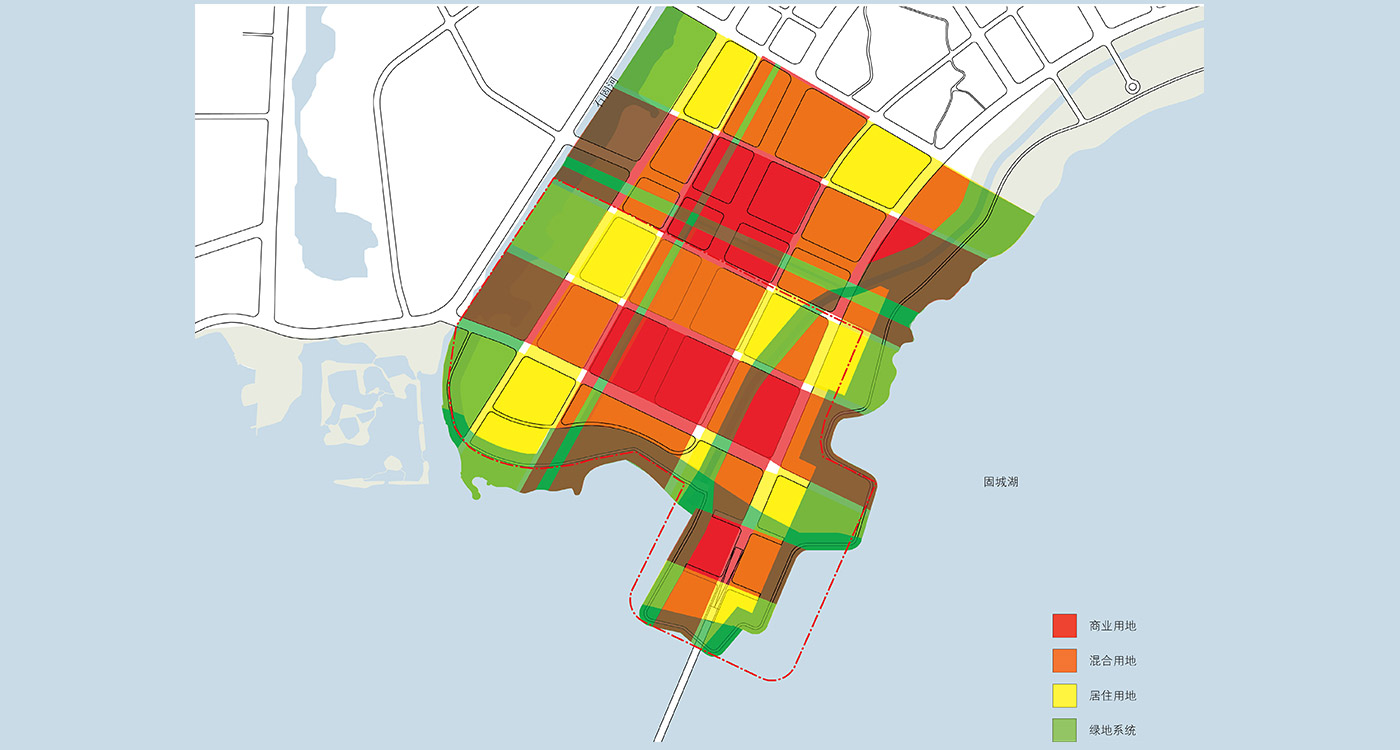
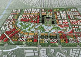
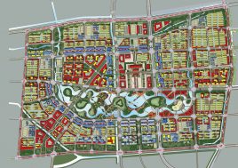
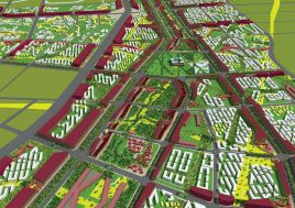
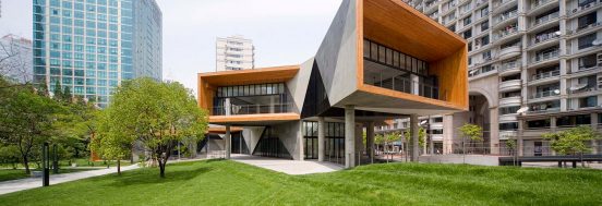
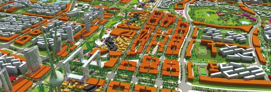
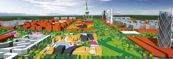
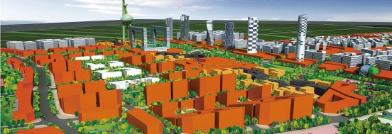
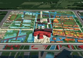
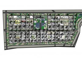
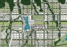
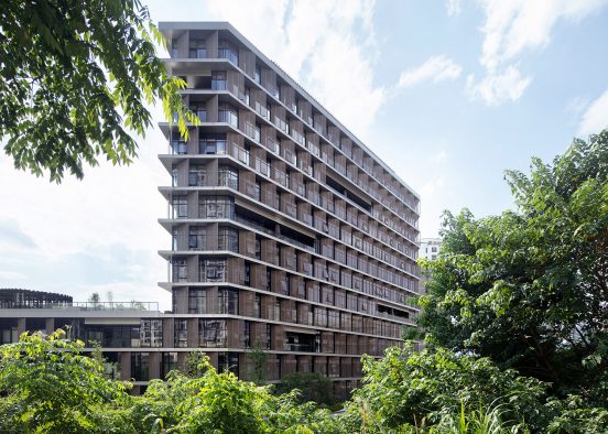
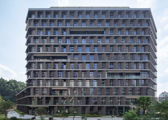
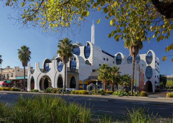
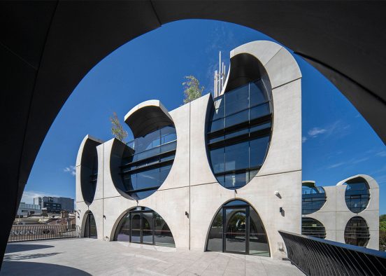
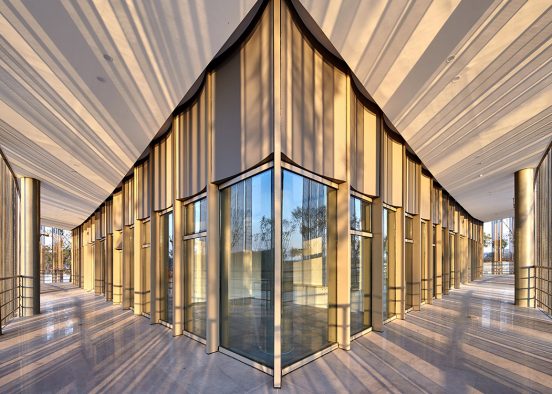
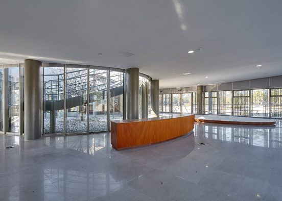
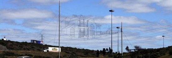
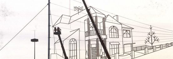
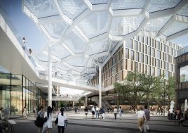
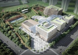
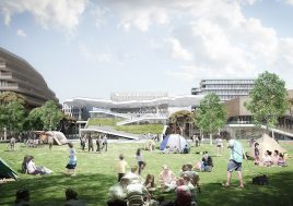
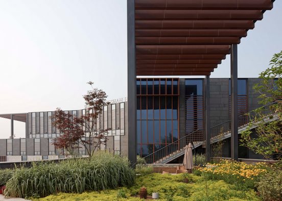
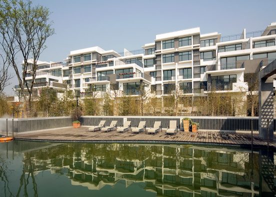
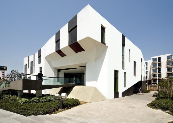
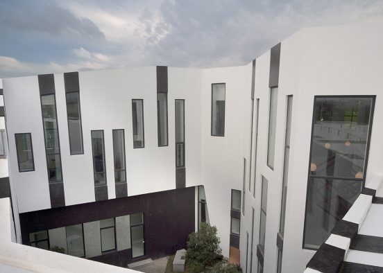
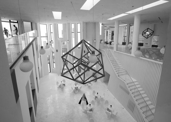
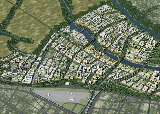
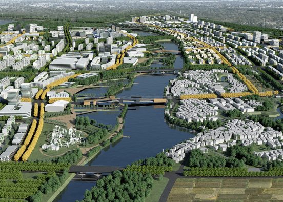
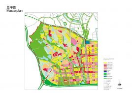
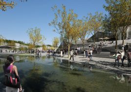
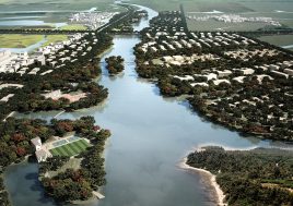
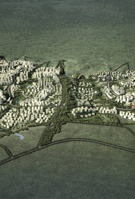
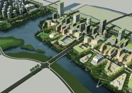
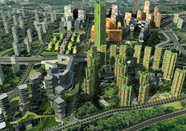
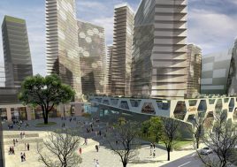
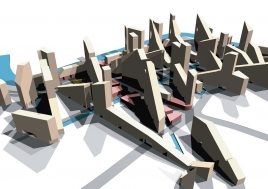
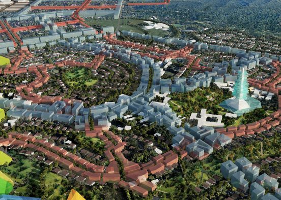
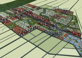
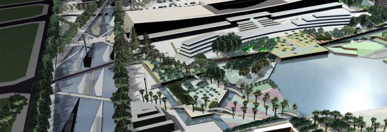
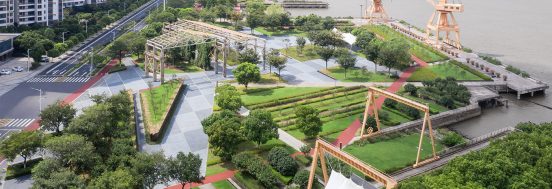
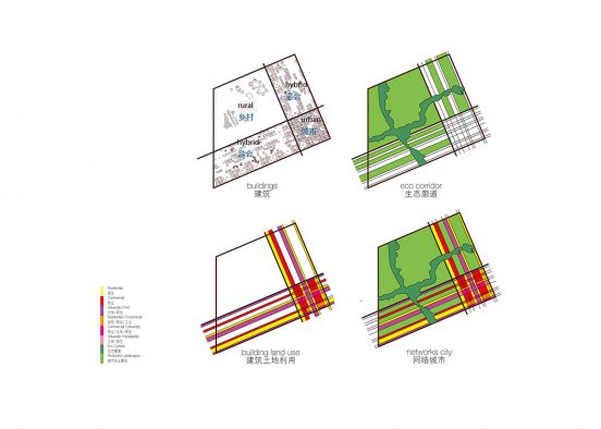
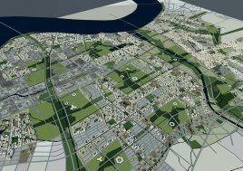
城市新区设计a plane of reference
introduction
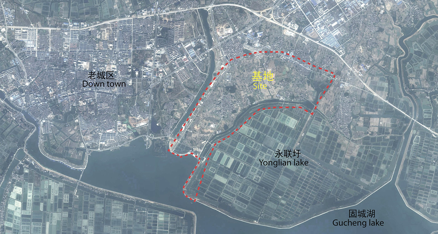
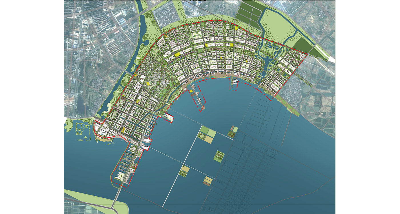
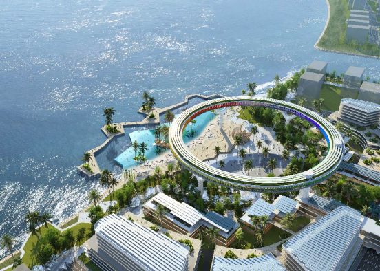
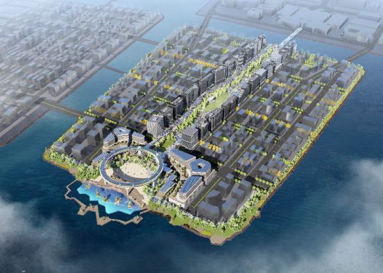
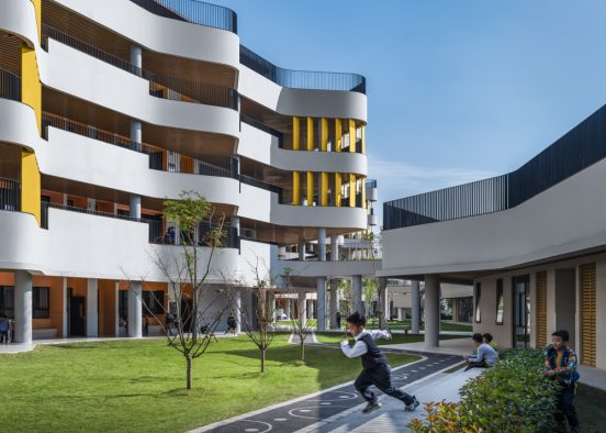
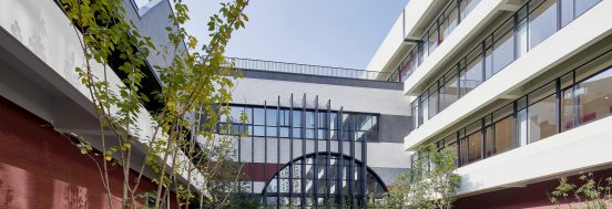
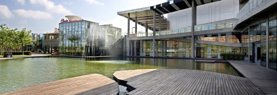
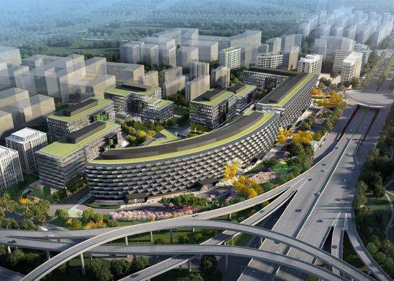
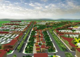
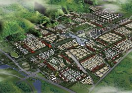
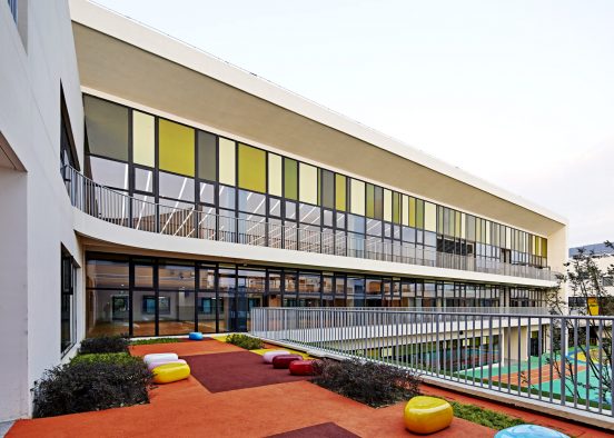
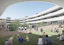
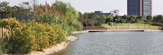
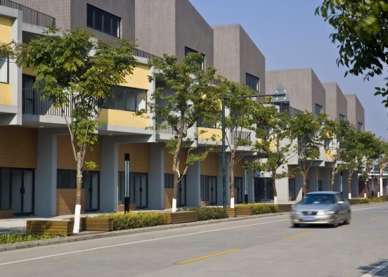
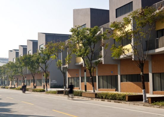
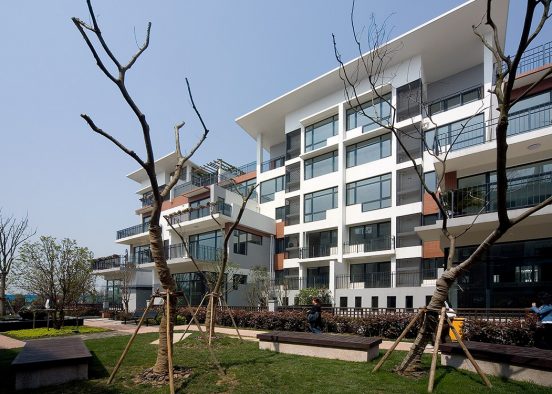
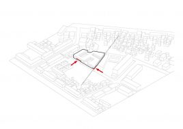
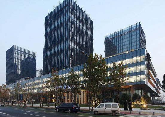
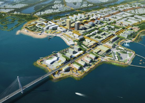
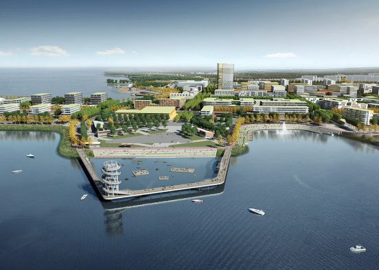
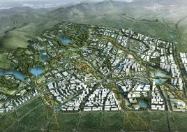
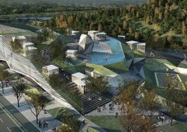
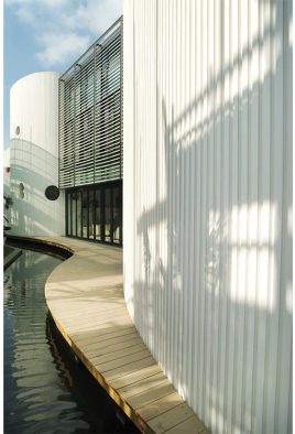
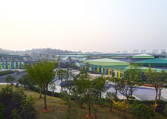
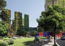
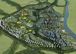
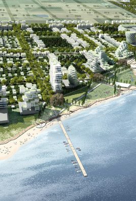
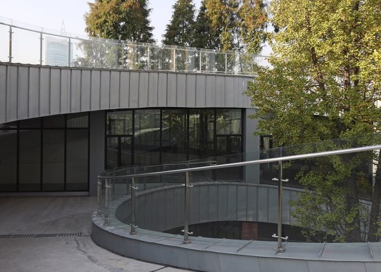
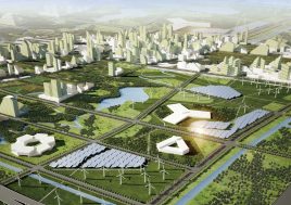
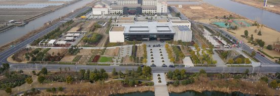
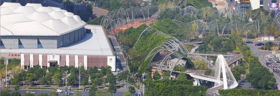
Gaochun is one of seven districts of the provincial capital Nanjing. Although situated 70 km south of the capital, the new freeway and light rail are enabling stronger ties and are fueling rapid growth. This 5sqkm urban expansion is one of Nanjing’s twenty planned Technology and Science Community (TSC) districts, or technopolises. It innovation potential is strengthened by its proximity to the adjacent industrial district and to a planned university campus to the east of the site. Being situated along the northern edge of Gu Cheng Lake makes it an ideal location for more than just hi-tech work places – this is a place for a complex and rich but specialized city.
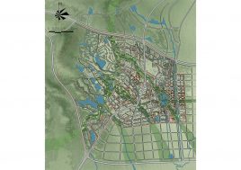
village preservation
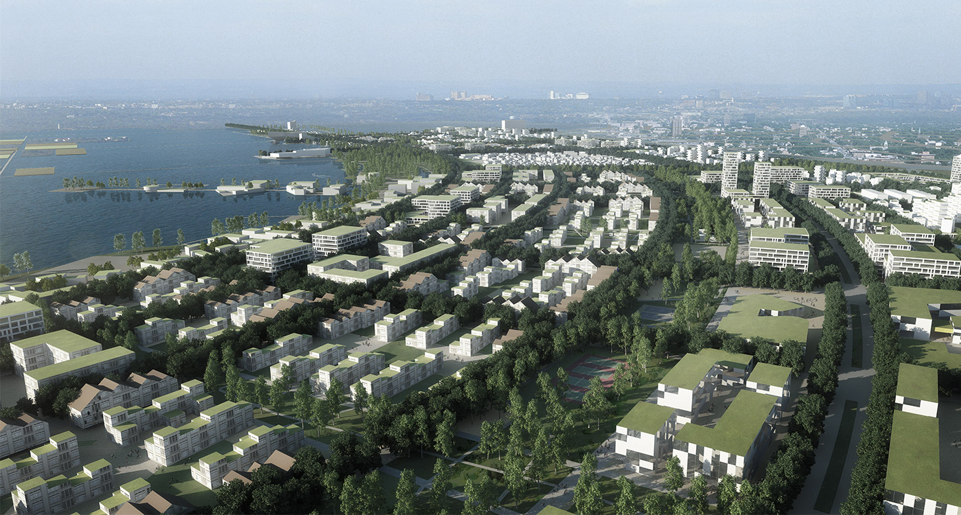
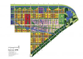
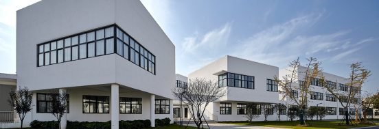
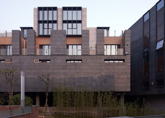
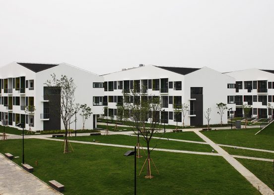
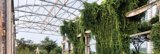
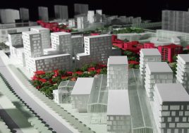
The first design decision was the preservation of the largest village on the site; maintaining the smaller settlements was not an option for the client. While this maintains some historical reference in the new city it also offers an urban spatial texture not provided by the demands of the contemporary city.
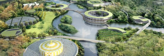
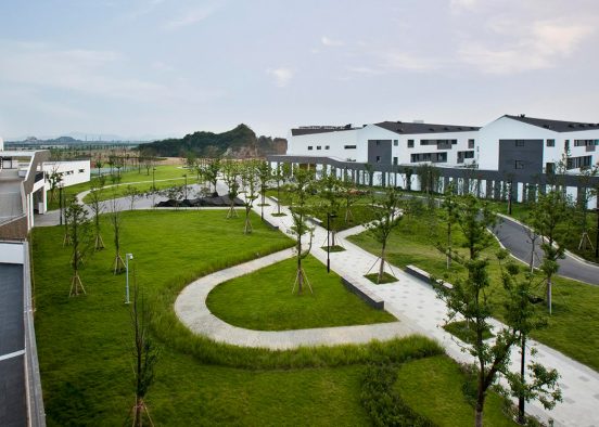
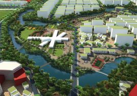
ecological network
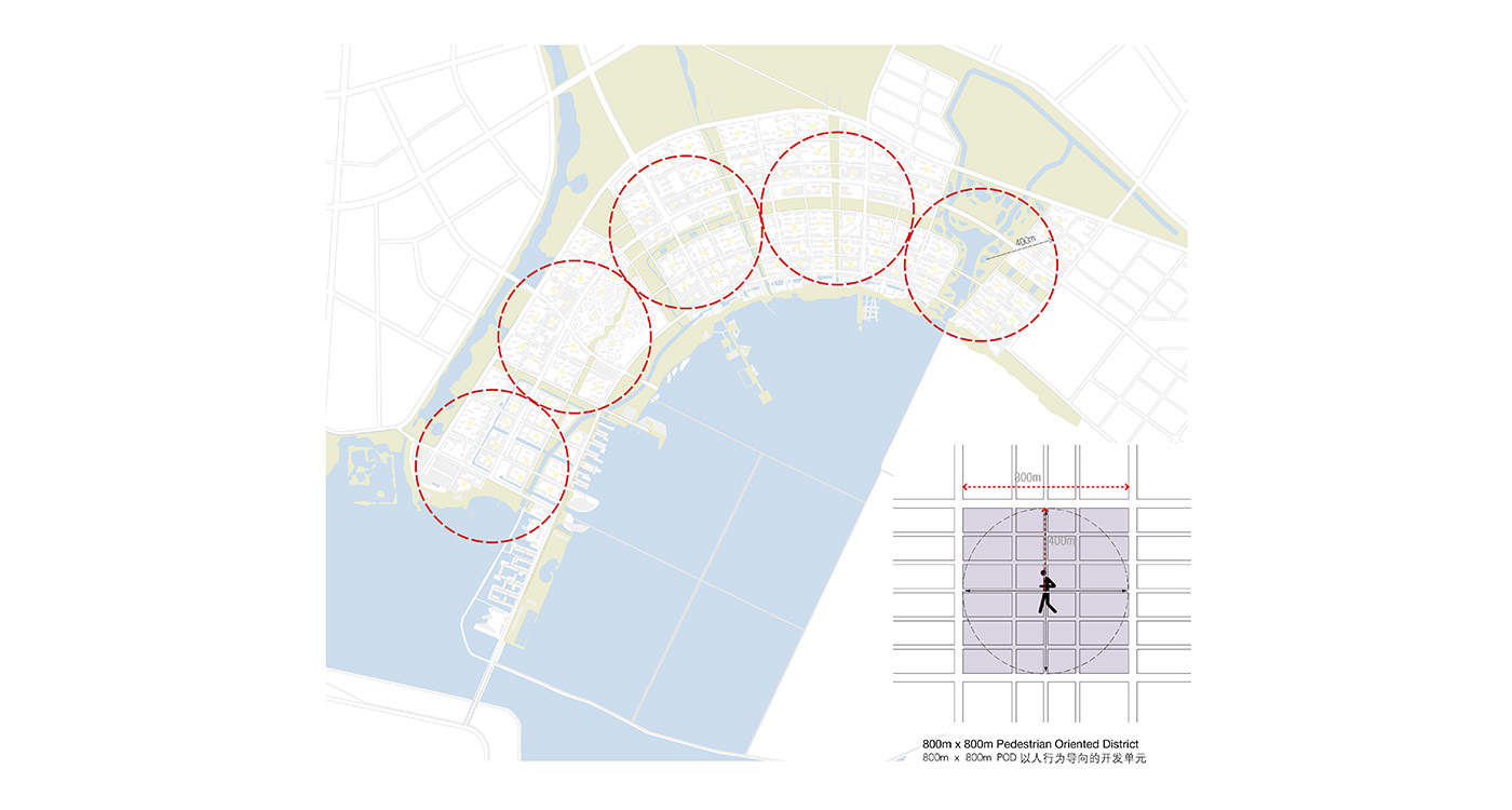
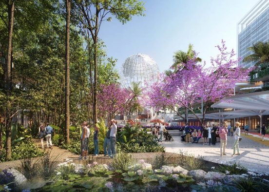
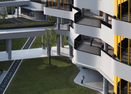
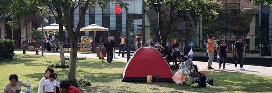
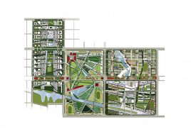
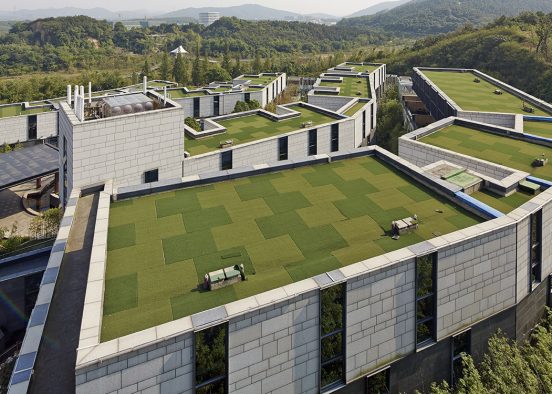
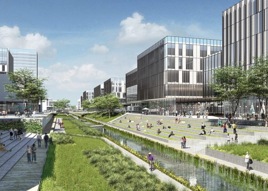
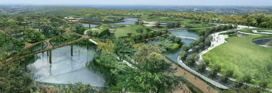
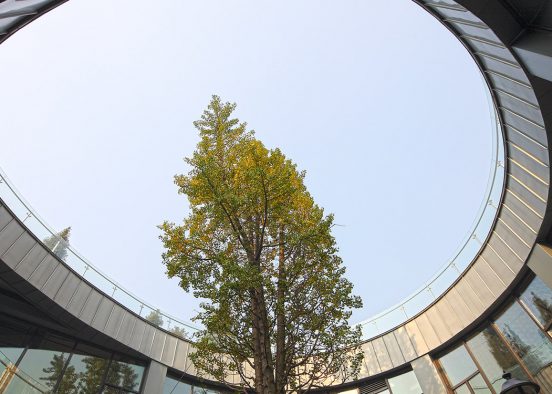
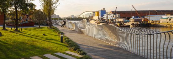
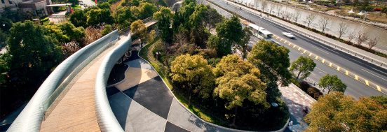
Water networks on the site were preserved and the larger wetlands maintained. These combine with additional green links to form a continuous park network within a 5 minute walk (400m) of all parts of the site.
public transport scale (TOD – LTA)
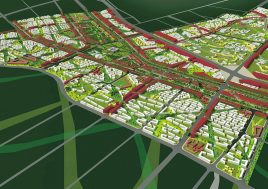
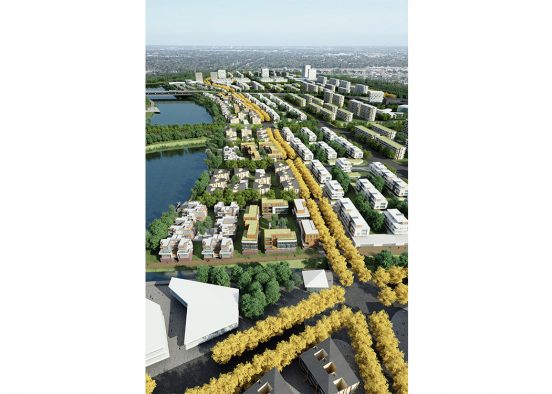
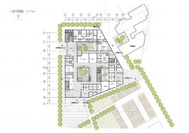
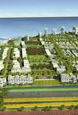
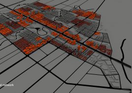
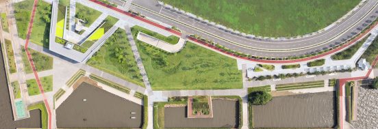
The site was then divided into five local transport areas (LTAs), approximately 800m x 800m. Public Transport (PT) routes were then centred in the LTAs, ensuring a 5 minute walk to public transport within each LTA. The future metro runs through part of the site touching the main PT east–west spine, with a metro station positioned at the centre of one of the LTAs.
community structure
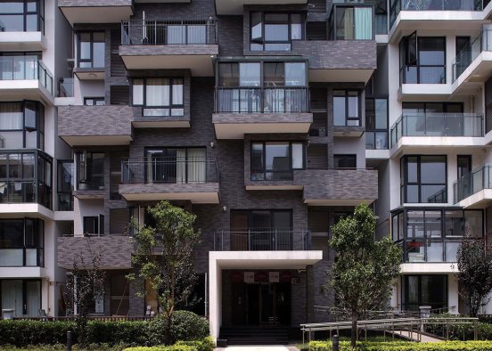
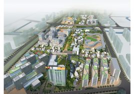
The LTAs are made up of four neighbourhoods (approximately 400m x 400m), and each neighbourhood is made up of four mosaics of sub-culture (200m x 200m). This community structure provides a rich and complex set of city scales that provide a sense of place and a sense of belonging to the community.
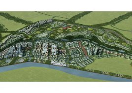
hierarchy of roads
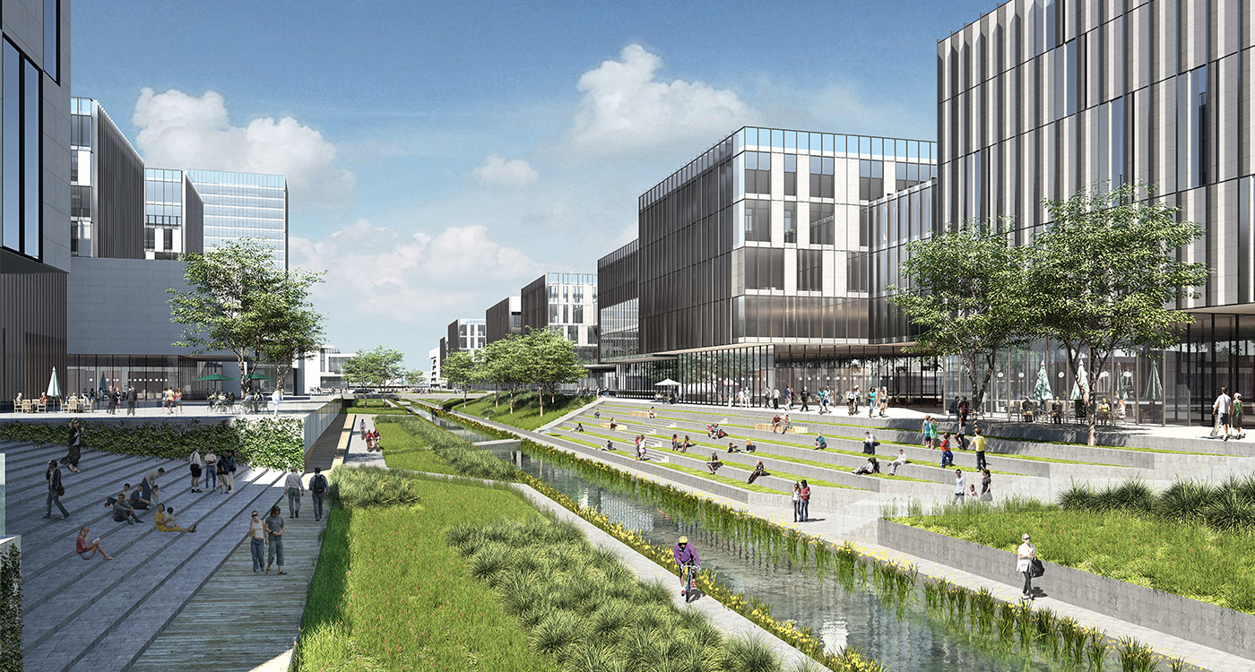
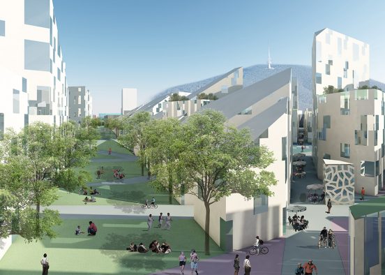
The highest traffic volume roads have been situated at the perimeter of each LTA to remove the need for people to cross major roads in their daily life. Central to each LTA is the commercial network which is attached to public transport. Other roads are designed as green quiet streets for living and or working.
small blocks
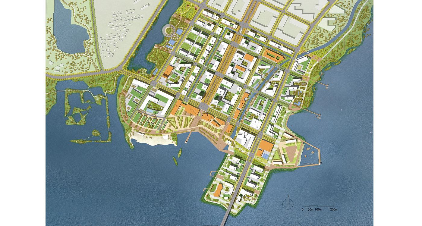
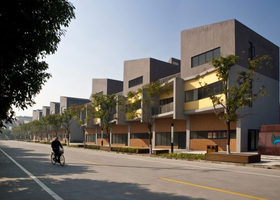
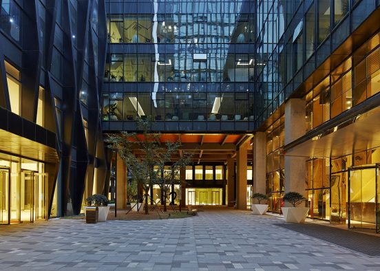
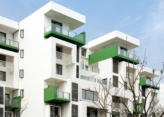
Like water rippling in a pond, one set of streets run parallel to the lake edge. The other set of streets run perpendicular to these avenues and produces a legible street morphology, with most of the perpendicular streets having a water view. A block size of between two and four hectares was selected in an attempt to balance market demands with urban design ideals. The market’s ideal is mega blocks to maximize development area. The urban design ideal is a smaller block providing a permeable (walkable) city with and even distribution of road traffic loads, an increase of building perimeters along streets, and an expansion of the public realm.
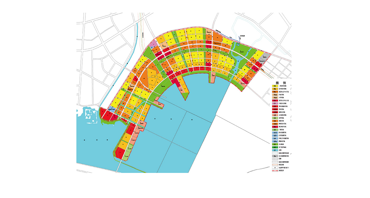
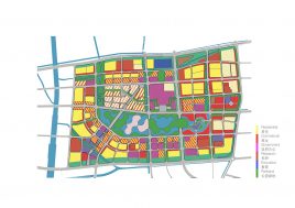
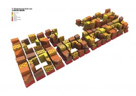
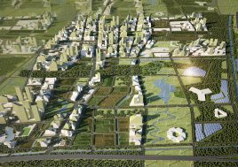
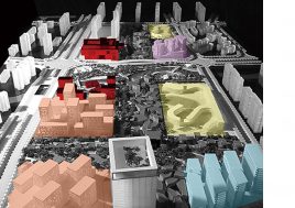
integrated land-use and networks zoning
To achieve a fine grained distribution of living and working programs across the site a continuous network of each program has been developed. The areas where these living and working land-use zones overlap one another are zoned hybrid (living-working) zones, maintaining a degree of flexibility to absorb the variance in demand caused by a cyclical development market. While hybrid land can be utilized as either living or working according to market demand, a minimum amount of each is maintained.
The commercial and retail network is situated along either side of the public transport network. As the city matures, its local retail, entertainment and support services will be free to emerge along these routes bringing these programs within a convenient 5 minute walk to all residents of the city.
no undies hanging on main street
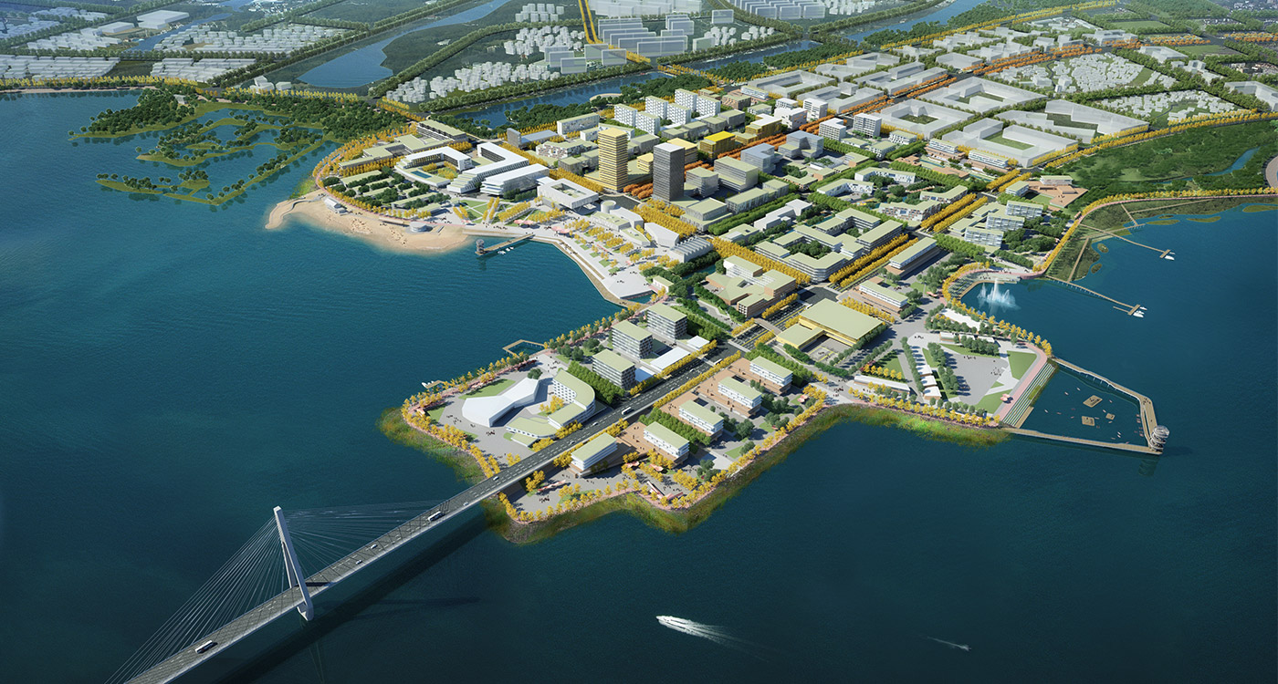
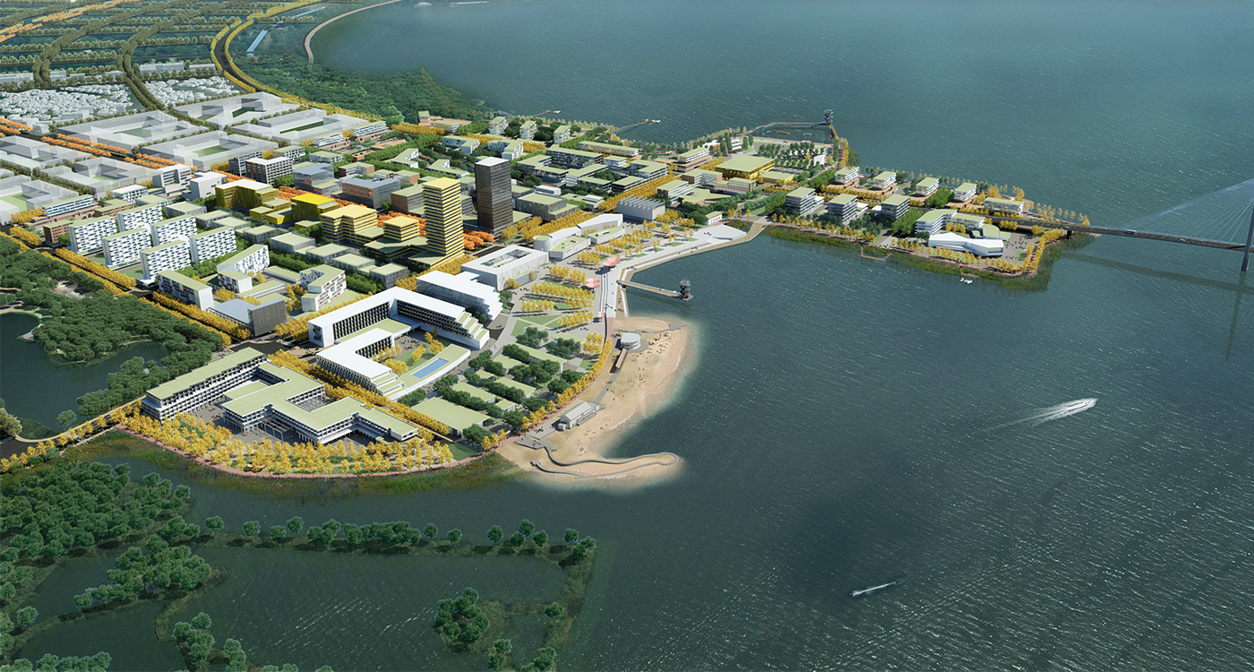
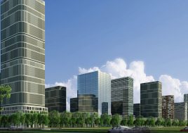
The east-west spine is seen as the public face of the district and is zoned for predominantly office and laboratory functions with service oriented street edges.
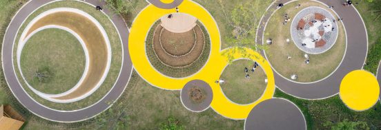
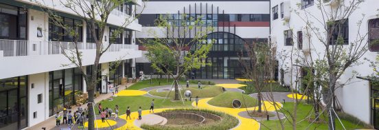
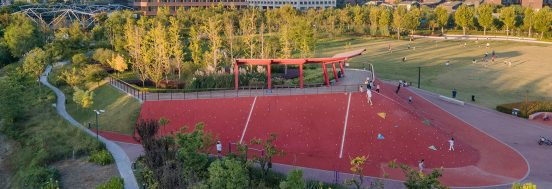
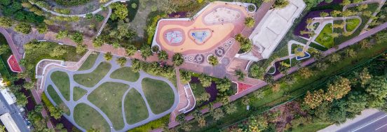
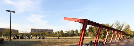
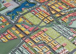
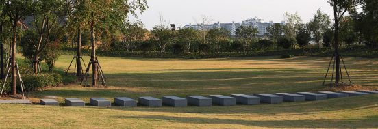
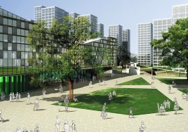
public open space – a fractal distribution
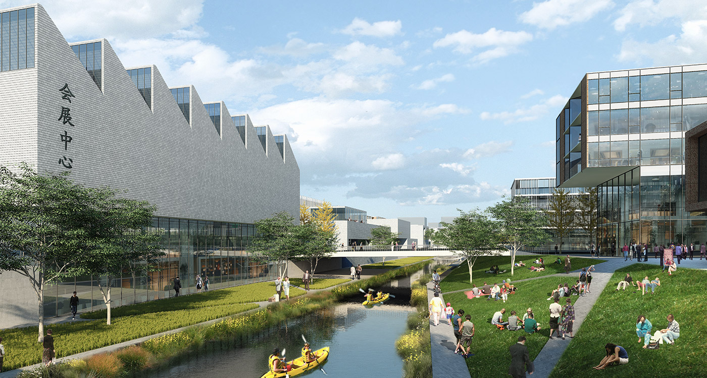
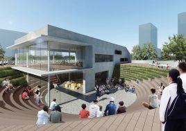
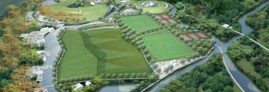
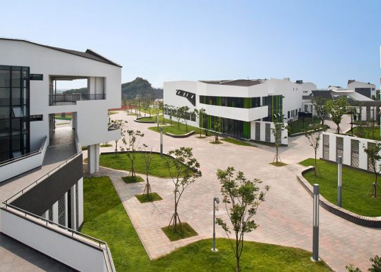
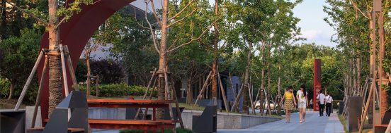
Each scale of community structure (LTA, neighbourhood, and mosaic of sub-culture) is provided with a park and a plaza. This develops into a system of fractal public open space distributed throughout the entire city. All these spaces are linked by the green street network.
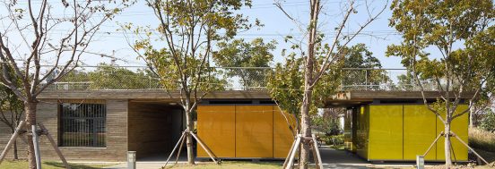
public programs
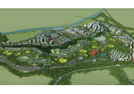
Public programs have been distributed across the site according to population density, walking distance and access to public transit and parks. Vegetable markets, supermarkets, hospitals, sports centers, community centres, schools and kindergartens are attached to the fractal open spaces.
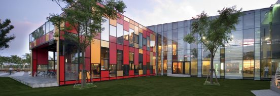
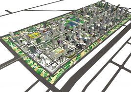
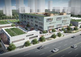
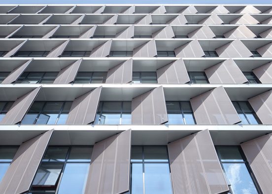
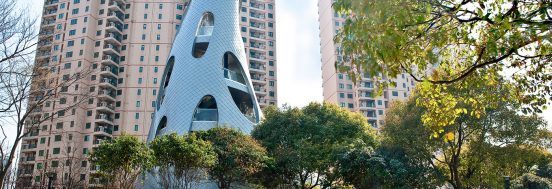
city form + sunny active edges
Height controls are driven by the need to protect solar access to the commercial network’s active street edges during winter lunchtime hours. These height controls also protect public open spaces, including the fractal open space network, from excessive overshadowing.
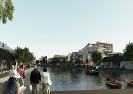
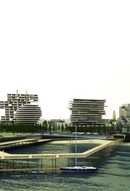
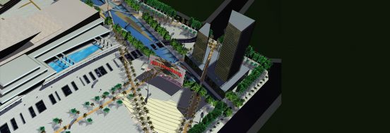
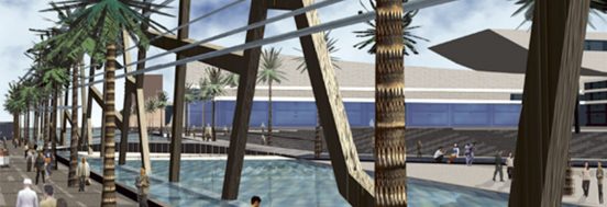
foreshore
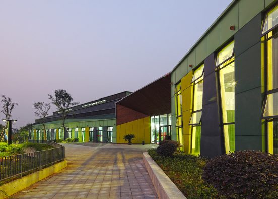
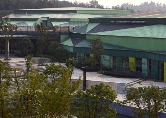
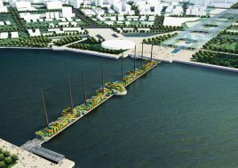
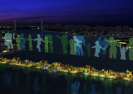
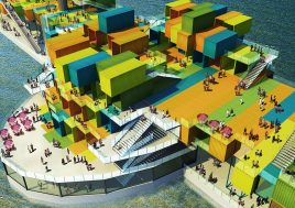
The networks of land use extend to the waterfront, bringing a diverse array of both ecological and urban areas, passive and active uses, and business and mixed residential programs to the water’s edge, piers and jetties. A necklace of public buildings take prime locations along this foreshore.
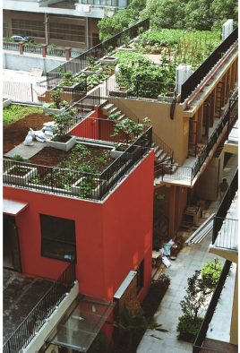
environmentally sustainable design – esd
Urban scale initiatives include a city scale sustainable urban drainage network, based primarily in the green network. A reduced dependence on travel and travel in private vehicles is enabled by the integrated live-work zoning and by the convenient distance (max 400m) to public transit. A combined services duct running along the central spine of the city and branching out to various extremities provides for ease of monitoring and future proofing for smart green technologies. A central green services plant for combined heat and power CHP plant is proposed for each of the LTAs.
公共空间景观
2000-2005
游乐场
构筑物及景观亭
2023
教育
公共
私有空间景观
2020
2019
办公
2005–2010
2021
文化
商业
酒店
综合
规划
城市设计
2013
餐饮娱乐
体育
教育
2018
2017
办公
文化
商业
2016
2011
住宅
基础设施
酒店
2015
医疗
2014
2012
医疗
餐饮娱乐
1990-2000
住宅
mythological wind machine: BAU025 Whale Watching Platform
中央公园,马尼拉,帕赛 360
学会放手
BAU641 上海师范大学附属青浦实验学校
比起莱维顿更像纳沃纳广场
BAU618 苏州新区,大阳山,苏州科技城第四幼儿园及第三小学
一座遍布功能项目的城市:
BAU119_上海金桥碧云体育休闲中心
景观、都市、网络、手提箱和纸袋:
BAU592 青浦赵巷体育公园
律动绿洲,超越凝固时刻:
BAU659 临空超大型围合式建筑
看!在天上!
BAU210 上海巴士弘轩办公楼
毫无疑问是中国制造-中国研发:
BAU588 上海金桥由度工坊
一种混合结构的基建设施:
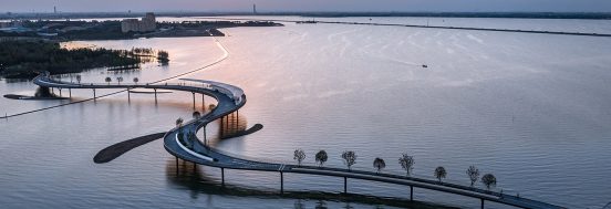
BAU679 环元荡贯通桥
大平原,小村落和中间平台:
BAU686 深圳龙岗艺术中心
BAU674 青浦演艺中心
BAU567 浦口社区服务中心
BAU206_杭州下沙新城市中心
BAU193_成都青羊区城市设计
BAU189_虹桥公园
BAU182_成都东村
BAU149_淮安大学城
BAU147_西安高新技术区CBD
BAU138_新余市高新技术经济开发区概念规划
BAU544_上海大学宝山校区
一座遍布功能项目的城市:
BAU119_上海金桥碧云体育休闲中心
旅程和目的地,而不仅仅是目的地:
BAU569 南京游府西街小学上秦淮分校
连续环路和内部庭院:
BAU603 苏州市第三幼儿园
编织与缝合:
BAU616 江阴绿道(一期东段)
BAU269 上海金地集团三林城项目会所
教育一个孩子需要一个村庄:
BAU602 苏州科技城西渚实验幼儿园
城市类型学、文化传统、当代理论和宇宙飞船:
BAU600 上海青浦新城一站大型居住社区30班小学
人造高地:创造更多空间:
BAU599 上海青浦新城一站大型居住社区24班初中
我们力所能及的:表现主义环境中的极简主义
BAU584 杭州桐庐办公大楼
比起莱维顿更像纳沃纳广场
BAU618 苏州新区,大阳山,苏州科技城第四幼儿园及第三小学
教室和其之间:超越教室的教与学
BAU610 华东师范大学附属台州学校
新世纪,新机构:
BAU604 青浦区人民法院
建造完善中:
BAU003M 维多利亚傲娇中心
最小与最大:
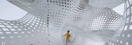
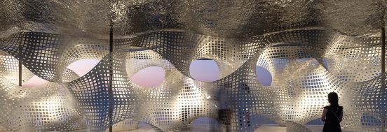
BAU583 南京高淳展览馆
建筑虽小,责任重大:
BAU027 温德姆陵园
BAU253 上海青浦仁恒运杰河滨花园入口花园
BAU402 上海青浦沁园湖公园
BAU268 江阴新桥商业街
BAU540 高淳区新区九年一贯制学校
一项关于稳固性的设计试验:
BAU333 江阴汇富广场
BAU222-2 上海青浦朱家角镇商业
超越但不止步:
BAU213-3 金地云湖超市
虚拟原型现实化:
BAU 213-2 金地云湖体育休闲中心
BAU021 Olinda 社区公共空间
BAU015 Jan Juc 住宅
BAU009 城市雕塑之空中楼阁
BAU019 Marymount 住宅、客房、马厩及办公
文化之城:
BAU590 南京海峡两岸科工园海桥社区服务中心
低调不失韵味:
BAU214 苏州清山酒店一期
积极的开发空间网络与蓝绿网络打造宜人、宜居的住宅小区:
BAU213-1 金地云湖住宅
BAU495 南京高淳瑶池精品酒店
BAU436 南京市江宁区示范幼儿园
远昭于山脊,近隐于群翠:
BAU424 苏州清山酒店二期
BAU238 江阴新桥社区中心广场
BAU199-2 无锡复地公园城邦住宅售楼处
综合了“步行城市”、“网络城市”和“城市节点”概念的城市设计:
BAU552 南京高淳城北科技新城
BAU547 南京桠溪镇中心卫生院
BAU546 南京高淳漆桥中心卫生院
复杂与简约共存的建筑:
BAU478-A 南京上秦淮U-Park孵化器
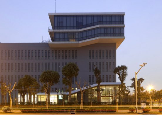
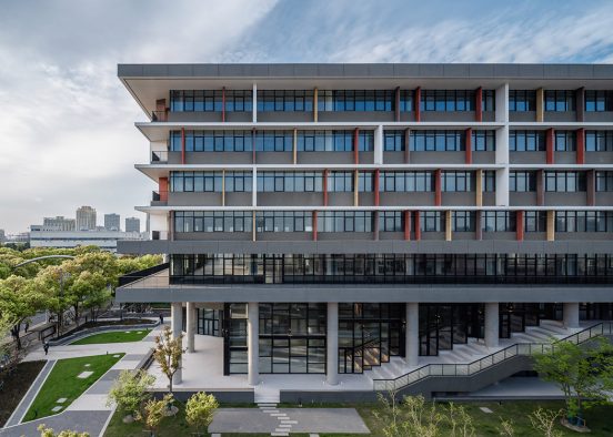
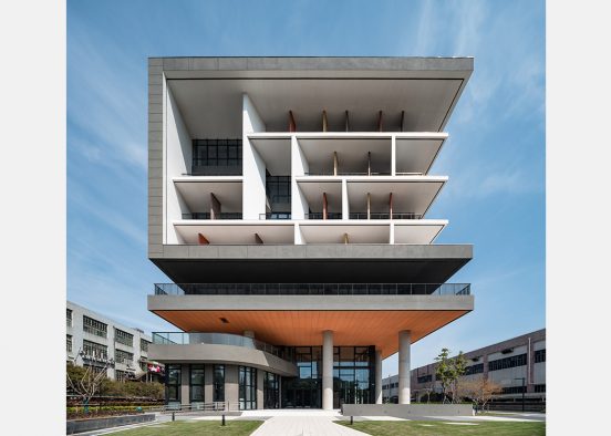
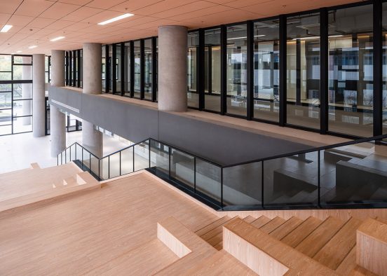
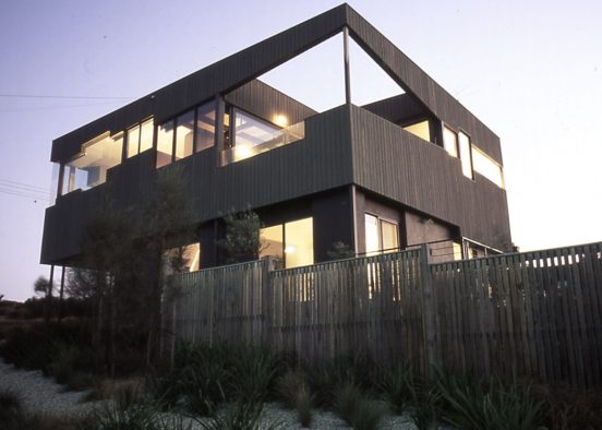
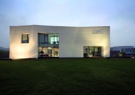
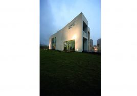
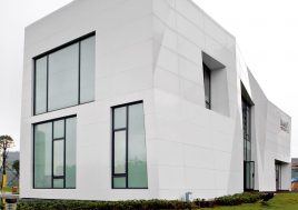
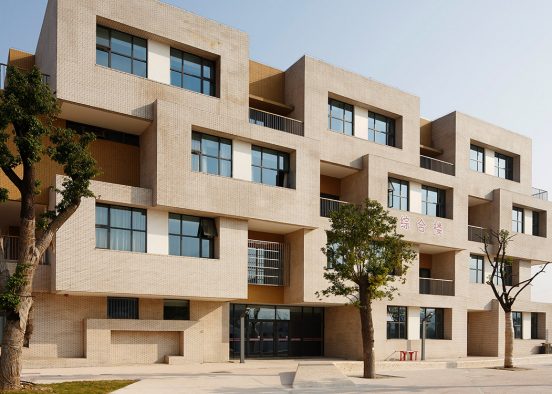
BAU474 南京紫金(高淳)科技创业特别社区城市设计
BAU461 南京汤山旅游度假区南片区
别具特色的医院:
BAU446 福鼎市医院
BAU445 苏州高新区文化中心
BAU426 绍兴鉴湖柯岩旅游度假区
BAU425 重庆生态谷城
城中之城:
BAU348 昆山康居新城江南片区商业街
BAU347 昆山白塔公园
改进类型学,而非重复使用!
BAU310 杭州长板巷住宅小区
BAU302 上海绿地宝山
独特的功能布局-将封闭空间转变成公共开放空间:
BAU254 上海外高桥文化中心
大型私人空间成为公共空间:
BAU199 无锡复地住宅小区
BAU197 金地三林售楼处
BAU191 武汉翠微园住宅
BAU227 杭州瑞成体育中心
BAU543_杭州严陵坞美丽乡村一期
地域建筑文化的抽象化传承:
BAU487 南京桠溪慢城小镇
BAU469_上海青浦赵巷卫生院
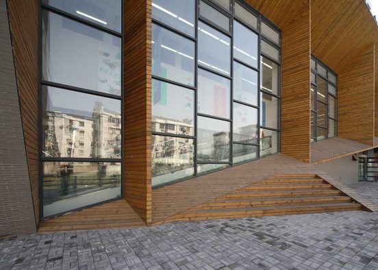
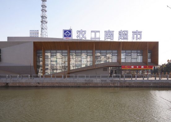
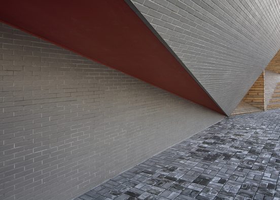
BAU247_上海青浦农工商超市
BAU324_慈溪市东部文化商务区城市设计
务实海洋中的抒情岛屿:
BAU530-1 南京高淳苏皖交通枢纽中心一期
BAU281_重庆华润规划设计
BAU243_上海外环公园
BAU204-2_宁波万达售楼处
BAU129_新湖明珠城住宅
BAU125_浙江电力公司总部大楼
BAU550_四川黄龙溪谷城市规划设计
BAU497_墨尔本温德姆海湾生态城镇规划
BAU470_堪培拉城市设计
BAU460_荆州博物馆
BAU396_南京骋望骊都住宅设计
BAU341_江阴郚山弯路学校
BAU338_金桥坡道餐厅
BAU321_江阴五星商业广场
BAU312_苏州科技城高级中学
BAU287_21世纪的维琪奥桥 :上海世博会桥
BAU285_成都北区中央活力区城市设计
BAU282_金地三林售楼处
BAU264_上海嘉善老市:旧工厂改造
文化与商业的交融:
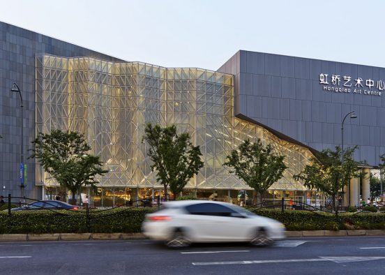
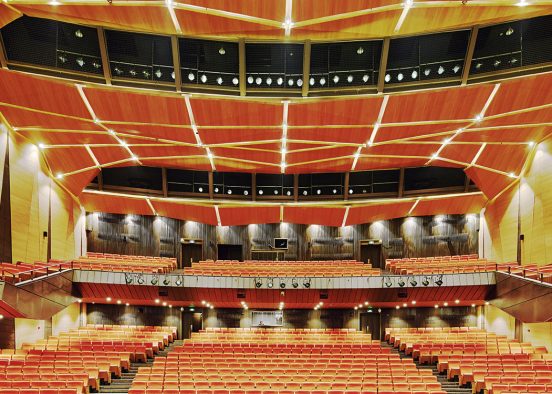
BAU256_上海虹桥艺术中心
BAU235_金桥蓝天路休闲酒吧
BAU220_上海雕塑艺术中心
BAU122_厦门国际会展中心广场规划设计
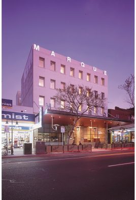
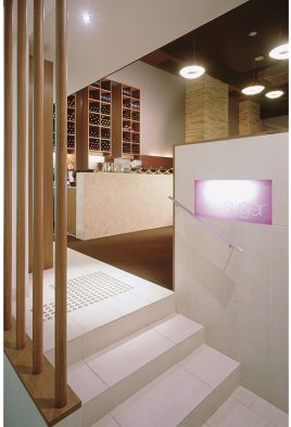
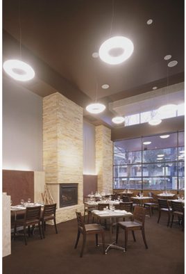
BAU018_Marque酒店
BAU016_Kelleher住宅
BAU013_霍普顿 生态度假村
BAU510_苏州有轨电车公司总部
BAU486A_江阴滨江公园
BAU433_张江诺贝尔湖绿地网络公园
BAU416_唯一之城——曹妃甸
BAU390_杭州多蓝水岸商业建筑
BAU386_杭州下沙共生城市
BAU384_昆山前进路小亭
BAU339-2&3_苏州河滨水步道
BAU339-1_苏州河-天原河滨公园

BAU318_杭州萧山政府办公楼
BAU234_江阴廊桥公园
BAU226_浦东洋泾地区中心规划设计
BAU224_成都市凤凰山


BAU208_临平新城市中心